
Hide
Edenham
hide
Hide
hide
Hide
hide
Hide
Hide
hide
Hide
Hide
The Library at Bourne should prove useful in your research.
- Cemetery Monument Inscriptions exist for the period of 1769 - 1911. These are available on microfilm from the Family History Library.
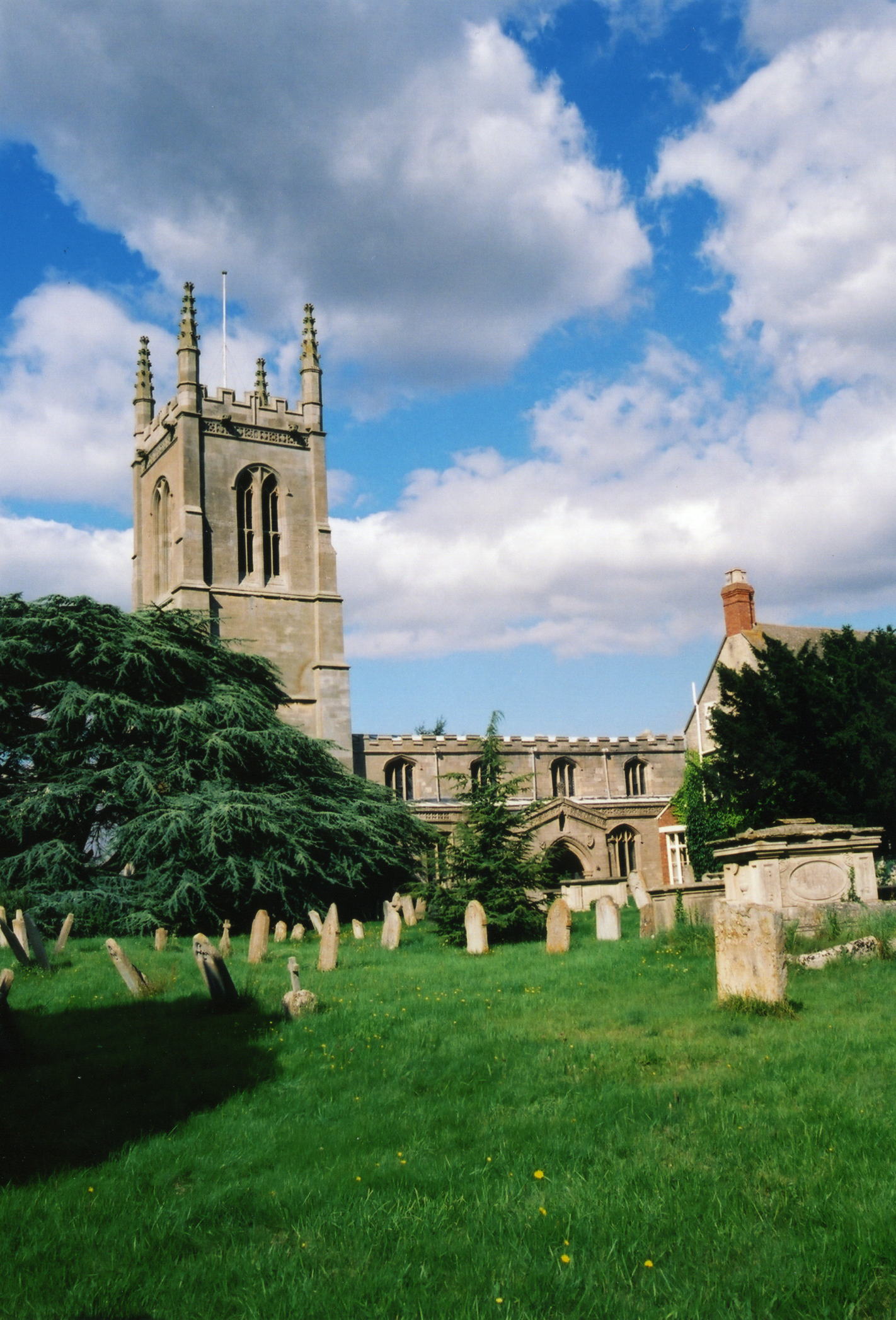
Robert HAVEY has a photograph of the church graveyard on Geo-graph, taken in November, 2014.
- The parish was in the Bourne sub-district of the Bourne Registration District.
- Check our Census Resource page for county-wide resources.
- The table below gives census piece numbers, where known:
| Census Year | Piece No. |
|---|---|
| 1841 | H.O. 107 / 618 |
| 1851 | H.O. 107 / 2095 |
| 1861 | R.G. 9 / 2317 |
| 1871 | R.G. 10 / 3314 |
| 1891 | R.G. 12 / 2557 |
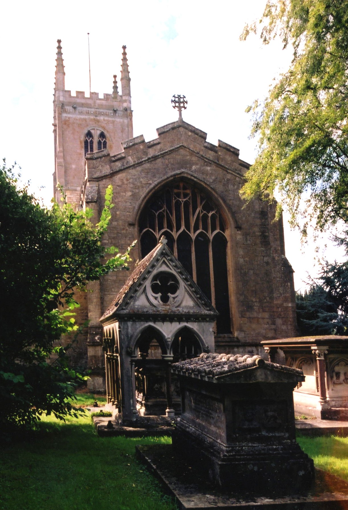
- The Anglican parish church is dedicated to St. Michael and All Saints.
- Inside St. Michael's Church is an 8th century Anglo-Saxon cross shaft depicting the feet and body of a tall standing figure, thought to represent St. John. Richard CROFT has a photograph of the Cross Shaft on Geo-graph, taken in August, 2014.
- The parish church was formerly appropriated to the Cistercian Abbey of "Valle Dei" which stood in the parish at Grimsthorpe Park, about a mile west of the village. The Cistertian Abbey was founded by William le GROS, 3rd Earl of Albemarle, about 1147. The Abbey was granted at the Dissolution to the Duke of Suffolk. Only a few stones now remain.
- The church tower is reputed to have been built in the reign of King Henry VI (1422 - 1461 and 1470-1471).
- The church is Grade I listed with English Heritage.
- The church seats 450.
- Here are two photographs of St. Michael's Church, taken by Ron COLE (who retains the copyright):
- The parish church registers exist from 1654, but Bishops' Transcripts take that back to 1561.
- The Lincolnshire FHS has published several marriage and a burial index for the Aveland and Ness Deanery.
- Check our Church Records page for county-wide resources.
- The parish was in the Bourne sub-district of the Bourne Registration District.
- Check our Civil Registration page for sources and background on Civil Registration which began in July, 1837.
This village and it's large parish (6,844 acres or 7,760 acres, depending on sources) is situated about 96 miles north of London, 3 miles west of Bourne on the A151 trunk road and 5 miles southeast of Corby parish. Witham-le-Hill parish is just to the south. The parish includes the hamlet of Grimsthorpe. The old hamlets of Elsthorpe and Scottlethorpe, now just a small cluster of houses each, are also within the parish.
The East Glen River flows southward through the village. If you are planning a visit:
- Jonathan THACKER has a photograph of the Footbridge over the East Glem River on Geo-graph, taken in April, 2021.
- See our touring page for visitor services.
- Ask for a calculation of the distance from Edenham to another place.
- Grimsthorpe Castle was the seat of Lord WILLOUGHBY de ERESBY. Near the castle is a lake. Most of the castle was built in the 13th century during the reign of Henry VIII, although some portions may have an earlier origin. The north front was added in 1722-3. The Great Hall is some 50 feet by 40 feet.
- Check out the website for Grimsthorpe Castle.
- See our Maps page for additional resources.
You can see maps centred on OS grid reference TF062218 (Lat/Lon: 52.783341, -0.426837), Edenham which are provided by:
- OpenStreetMap
- Google Maps
- StreetMap (Current Ordnance Survey maps)
- Bing (was Multimap)
- Old Maps Online
- National Library of Scotland (Old Ordnance Survey maps)
- Vision of Britain (Click "Historical units & statistics" for administrative areas.)
- English Jurisdictions in 1851 (Unfortunately the LDS have removed the facility to enable us to specify a starting location, you will need to search yourself on their map.)
- Magic (Geographic information) (Click + on map if it doesn't show)
- GeoHack (Links to on-line maps and location specific services.)
- All places within the same township/parish shown on an Openstreetmap map.
- Nearby townships/parishes shown on an Openstreetmap map.
- Nearby places shown on an Openstreetmap map.
- The Royal Flying Corps established an emergency landing ground here in World War One. By war's end, this was RAF Grimsthorpe Park.
- In World War II the field was used as a bombing range.
- Robert HARVEY has a photograph of a framed Roll of Honour on the churchwall on Geo-graph, taken in January, 2016.
There are 14 names listed on the War Memorial Plaque.
The Commonwealth War Grave in the churchyard is for:
- William Stanley LYNN, priv., 8th Btn. Lincs Regt., age 21, died 2 Feb. 1918. Son of Thomas LYNN, Edenham.
- The name comes from the Old English Eada+n+ham for "Eada's homestead" and appeared in the 1086 Domesday Book as Edeneham.
[A. D. Mills, "A Dictionary of English Place-Names," Oxford University Press, 1991]
- John Bland tells us (2004) that the locals pronounce the name as "Ed-e-nam", not "Eden-ham".
- This place was an ancient parish in Lincoln county and became a modern Civil Parish when those were established.
- Jonathan THACKER has a photograph of the Village Hall on Geo-graph, taken in April, 2021. Be sure to stop in when they are open and ask to see the schedule of forth-coming events.
- You may contact the Edenham Parish Council regarding civic or political matters, but they are NOT funded to do family history searches for you.
- The parish was in the ancient Beltisloe Wapentake in the South Kesteven district in the parts of Kesteven.
- For today's local governance, contact the South Kesteven District Council.
- Bastardy cases would be heard in the Bourne petty session hearings.
- In 1727, Anthony BARNES, who died in Grimsthorpe, left property as the income for a charitable dole to poor folk.
- In 1730, John PELL left the interest from £100 as a dole for the poor.
- Please see our Bourne Poor Law Union page for more information.
- In 1841, Lady WILLOUGHBY supported a school for the education of 40 poor girls. In 1873, a new school building allowed for up to 150 students.
- Also by 1841, there was a boys' school here.
- For more on researching school records, see our Schools Research page.