Hide
Freiston
hide
Hide
hide
Hide
hide
Hide
Hide
Hide
Caution: "Freiston" is a village and a parish on the shore near Boston. The village is also known as "Freiston Shore", although that name, technically, applies only to a part of the village close to the ocean. There is another hamlet called "Frieston" (note the spelling) or "Friston" in Caythorpe parish just south of Caythorpe village. Please make sure that you are searching in the correct place. All these spellings are provided by the Lincolnshire Family History Society.
Hide
The Library at Boston will prove useful in your research.
- The parish was part of the Benington sub-district of the Boston Registration District.
- Check our Census Resource page for county-wide resources.
- The table below gives census piece numbers, where known:
| Census Year | Piece No. |
|---|---|
| 1841 | H.O. 107 / 607 |
| 1851 | H.O. 107 / 2098 |
| 1861 | R.G. 9 / 2333, 2334 and 2375 |
| 1871 | R.G. 10 / 3337 - 3338 |
| 1881 | R.G. 11 / 3215 |
| 1891 | R.G. 12 / 2571 |
- A Benedictine Priory was founded here in 1114 on land donated to Crowland Abbey by Guy de CRUON or CREDON. In 1687, the Priory building and lands were granted to the DRYDEN family.
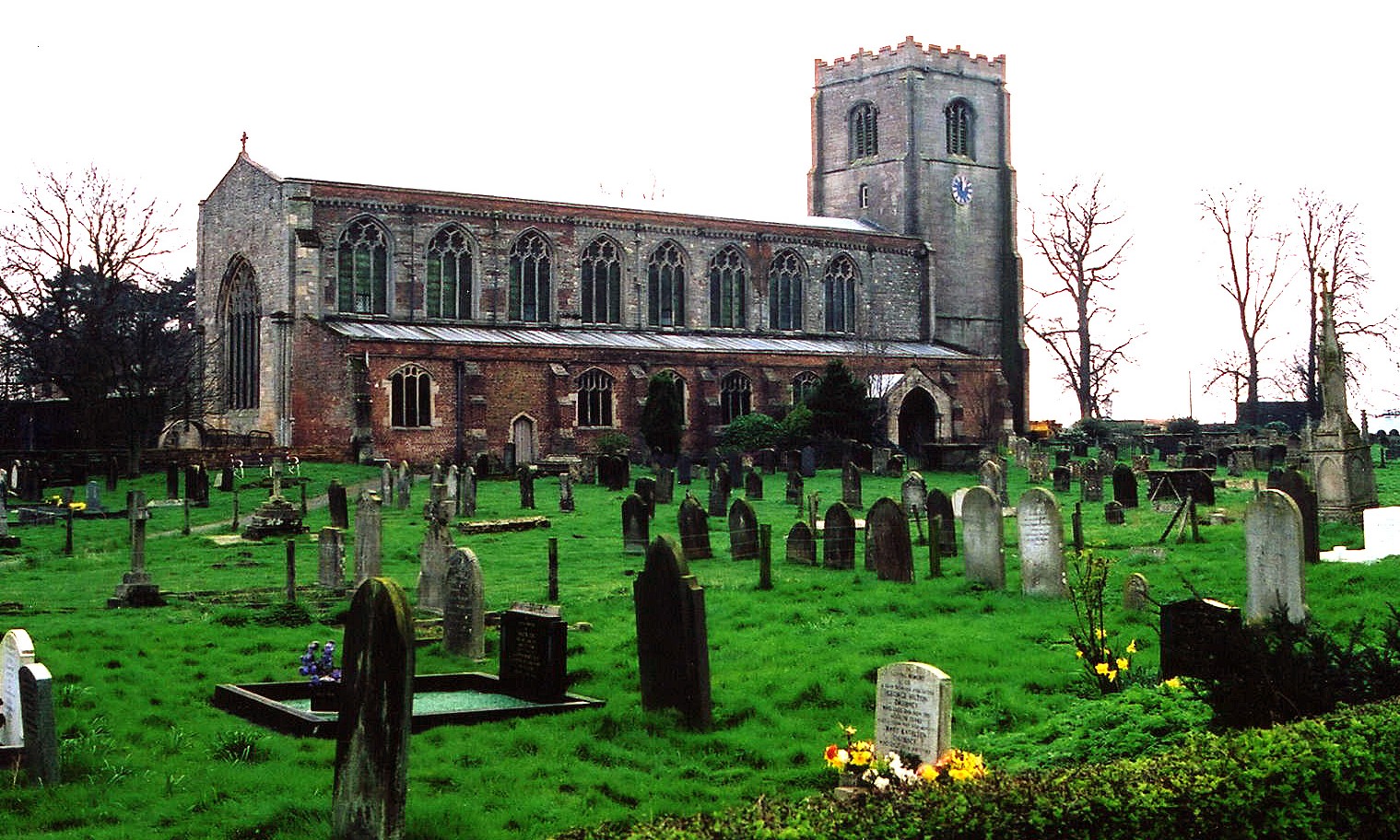
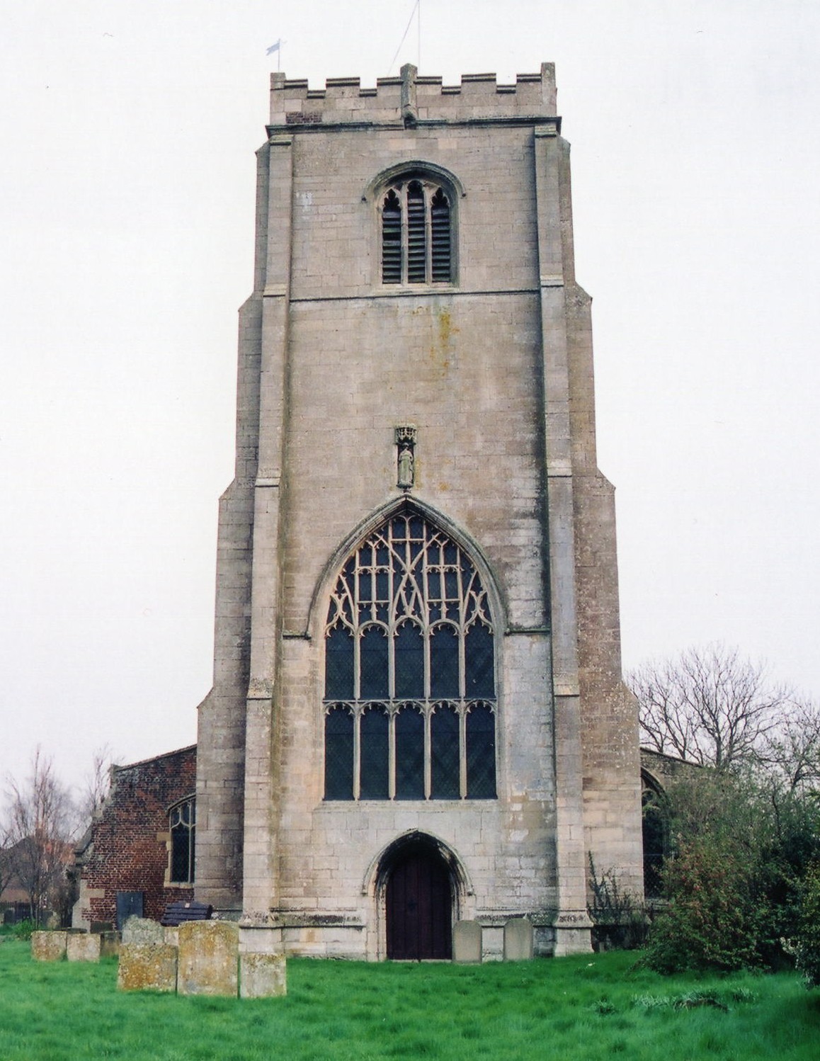
- The Anglican parish church is dedicated to St. James.
- The church is of Norman origin.
- The organ was installed in 1869.
- The church was restored in 1871.
- The church seats 577.
- The church is called a "ship of the Fens" and contains several Norman carvings of interest.
- Here are two photos of St. James church, taken by Ron COLE (who retains the copyright):


- The Anglican parish register dates from 1681.
- The Anglican parish register exists on microfilm at the Family History Library in Salt Lake City. The films cover baptisms and burials up to the 1890's, but marriages only up to 1837.
- The Anglican parish register is on deposit at the Lincoln Archives for the period of 1657 to 1985.
- We have the beginning of a parish register extract in a pop-up text file for your use. Your additions and corrections will be welcome.
- The LFHS has published several indexes for the Holland East Deanery to make your search easier.
- The Wesleyan Methodists built a chapel here in 1838. It was replaced by a newer, larger chapel in 1866.
- The United Methodists had a chapel built here in 1887 at Scrane End.
- For information and assistance in researching these chapels, see our non-conformist religions page.
- Check our Church Records page for county-wide resources.
- The parish was in the Benington sub-district of the Boston Registration District.
- Check our Civil Registration page for sources and background on Civil Registration which began in July, 1837.
Down near the Sea Bank lies HM Prison North Sea Camp which opened in 1935. It is not a county facility. Ian PATERSON has a photograph of the Entry Road on Geo-graph, taken in May, 2008.
Freiston, or Frieston, is both a village and a parish in Lincolnshire, 3 miles east of Boston. The parish covers about 5,200 acres of low, well-drained Fenland.
White's 1872 Directory describes "a pleasant straggling village, bearing the names of Church end and Halltoft-end." Haltoft End is a village just to the north of Freiston village. The parish also includes the hamlets of Freiston Shore and Crane-end (or "Scrane End"). If you are planning a visit:
- Ask for a calculation of the distance from Freiston to another place.
- In 1842 the parish had nine fishing boats employed in catching herring, shrimp, sprats, sole and oysters.
- The parish had a Coast Guard station at Freiston Shore's manned by only two people in 1913.
- The Castle Inn at Halltoft End was a good place for conversation. The Inn is still in business and can be checked out at Bateman's Pubs. These are the names associated with the place in various directories:
| Year | Person |
|---|---|
| 1842 | Wm. HURST |
| 1856 | Abraham Booth CLARK |
| 1872 | William HICKMAN, vict. |
| 1882 | John LEGGOTT, vict. |
| 1900 | Jn. LEGGOTT, farmer |
| 1913 | Mrs. Matilda LEGGOTT |
| 1930 | Fredk. BOSNELL |
- Rooshall was the manor of Henry ROGERS in 1871.
- Three smaller manors were Coupledyke Hall, Poynton Hall, and Peachy Hall. Peachy Hall had been torn down by 1871 and the land for it belonged to a Colonel LINTON.
- See our Maps page for additional resources.
You can see maps centred on OS grid reference TF377438 (Lat/Lon: 52.973873, 0.049217), Freiston which are provided by:
- OpenStreetMap
- Google Maps
- StreetMap (Current Ordnance Survey maps)
- Bing (was Multimap)
- Old Maps Online
- National Library of Scotland (Old Ordnance Survey maps)
- Vision of Britain (Click "Historical units & statistics" for administrative areas.)
- English Jurisdictions in 1851 (Unfortunately the LDS have removed the facility to enable us to specify a starting location, you will need to search yourself on their map.)
- Magic (Geographic information) (Click + on map if it doesn't show)
- GeoHack (Links to on-line maps and location specific services.)
- All places within the same township/parish shown on an Openstreetmap map.
- Nearby townships/parishes shown on an Openstreetmap map.
- Nearby places shown on an Openstreetmap map.
- The Royal Navy opened an airstation here on or before 1916.
- RNAS Freiston was an armament training school until April 1918, when they started to teach the art of dog-fighting.
- The field was closed in 1920.
- Chris has a photograph of the WW1 Freiston airfield on Geo-graph, taken in October, 2017. The field is near Scrane End.
- There is a photograph of the War Memorial plynth in the churchyard at Geo-graph, taken by Jim DUGDALE, taken in August, 2005.
- Richard CROFT has a photograph of the Freiston Bridge pillbox from WWII on Geo-graph, taken in July, 2007.
- Richard CROFT also has a photograph of the Churchyard pillbox from WWII on Geo-graph, taken in July, 2009.
Three Canadian airmen are buried in the parish churchyard. All perished in accidents while flying Sopwith Camels:
- Edward Lambert BACH, age 21, from Toronto.
- John William DOWLING, age 21, from Vancouver.
- John Freele MEEK, from Ontario.
We have the inscription from the War Memorial in a pop-up text file. The names were supplied by John EMERSON in 2002.
- This place was an ancient parish in Lincoln county and became a modern Civil Parish when those were established.
- The parish was in the ancient Skirbeck Wapentake in the parts of Holland.
- In December, 1880, this parish was reduced in size to enlarge West Fen Civil Parish.
- You may contact the local Freiston Parish Council regarding civic or political issues, but they are NOT tasked with assisting you with family history searches.
- For today's district governance, visit the local Boston Borough Council.
- Bastardy cases would be heard in the Kirton and Skirbeck petty session hearings.
- The parish's "Town Estate" purchased 7 acres in 1679. The rental revenue was distributed to the poor in the form of coal.
- Barney Field was allocated to the poor also, either in terms of rental income or direct allocation of plots for cultivation. The following individuals contributed toward the land: Benjamin MORFOOT, John ANTON, James MANN, Simon GUY, William SWIFT and others. Read the Will of Benjamin MORFOOT from 1727.
- The parish also had 15 cottages on land near the church left by Thomas TRUESDALE in 1694. These were given rent-free to poor families.
- The Common Lands were enclosed here in 1762.
- After the Poor Law Amendment Act reforms of 1834, this parish became part of the Boston Poor Law Union.
Kitty PARKER provides a transcript of the will of MORFOOT, Benjamin of Freiston.
- A National School was built by subscription here around 1791 (then called a "Free School"), and was rebuilt in 1848. John HOLDEN donated just over two acres of land for it in 1723, and Benjamin MORFOOT donated a yearly rent charge in 1727.
- See our Schools page for more information on researching school records.
