
Hide
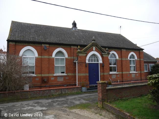
Bourne-Clowes Chapel, Chapel Lane, Great Hale, Methodist (Primitive)
hide
Hide
Hide
Methodist (Primitive) church,
Bourne-Clowes Chapel, Chapel Lane,
Great Hale
Bourne-Clowes Chapel, Chapel Lane,
Great Hale
Hide
It was located at TF1504242935 (Lat/Lon 52.971441, -0.288341). You can see this on maps provided by:
- OpenStreetMap
- Google Maps
- StreetMap (Current Ordnance Survey maps)
- Bing (was Multimap)
- Old Maps Online
- National Library of Scotland (Old Ordnance Survey maps)
- Vision of Britain (Click "Historical units & statistics" for administrative areas.)
- English Jurisdictions in 1851 (Unfortunately the LDS have removed the facility to enable us to specify a starting location, you will need to search yourself on their map.)
- Magic (Geographic information) (Click + on map if it doesn't show)
- GeoHack (Links to on-line maps and location specific services.)