
Hide
Little Steeping
hide
Hide
hide
Hide
hide
Hide
Hide
Hide
- The parish was in the Spilsby sub-district of the Spilsby Registration District.
- Check our Census Resource page for county-wide resources.
- The table below gives census piece numbers, where known:
| Census Year | Piece No. |
|---|---|
| 1841 | H.O. 107 / 645 |
| 1851 | H.O. 107 / 2109 |
| 1861 | R.G. 9 / 2374 - 75 |
| 1871 | R.G. 10 / 3391 |
| 1891 | R.G. 12 / 2603 |
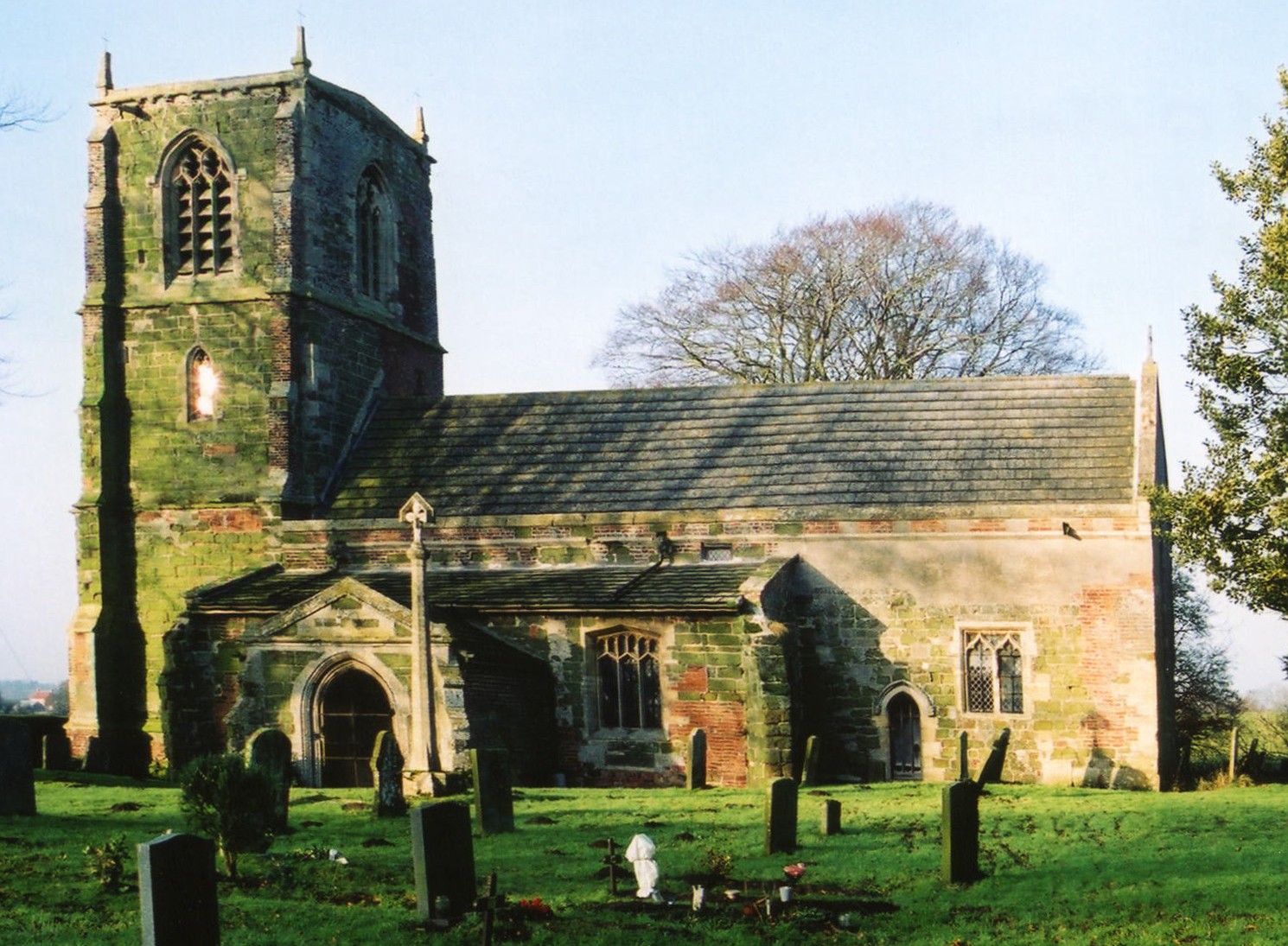
- The Anglican parish church is dedicated to St. Andrew. It is the third church built on this site.
- The churchyard was enlarged by 1/2 acre in 1891.
- The church seats about 150.
- There is a photograph of St. Andrew's Church on the Wendy PARKINSON web site under "more Lincolnshire".
- Here is a photo of St. Andrew's, taken by Ron COLE (who retains the copyright):
- The Anglican parish register dates from 1559.
- We have a small Church Register extract text file, to which your additions are welcome.
- The Lincolnshire FHS has published several marriage indexes and a burial index for the Bolingbroke Deanery to make your search easier.
- Kelly's 1900 Directory of Lincolnshire places this parish in the rural deanery of Candleshoe.
- There was a Wesleyan Methodist chapel in the parish. For information and assistance in researching these chapels, see our non-conformist religions page.
- Check our Church Records page for county-wide resources.
- The parish was in the Spilsby sub-district of the Spilsby Registration District.
- Check our Civil Registration page for sources and background on Civil Registration which started in July, 1837.
Little Steeping is a parish 120 miles north of London, 3 miles south-east of Spilsby and west of Skegness. Eastville parish lies to the south-west. The parish lies on the south bank of the River Limb and covers about 1,090 acres.
Little Steeping village starts at the Steeping River and runs southward. If you are considering a visit to the parish:
- By automobile, take the B1195 east out of Spilsby toward Wainfleet. Turn south (right) after Halton Holegate.
- See our touring page for more sources.
- Ask for a calculation of the distance from Little Steeping to another place.
- See our "Maps" page for additional resources.
You can see maps centred on OS grid reference TF434627 (Lat/Lon: 53.142549, 0.143166), Little Steeping which are provided by:
- OpenStreetMap
- Google Maps
- StreetMap (Current Ordnance Survey maps)
- Bing (was Multimap)
- Old Maps Online
- National Library of Scotland (Old Ordnance Survey maps)
- Vision of Britain (Click "Historical units & statistics" for administrative areas.)
- English Jurisdictions in 1851 (Unfortunately the LDS have removed the facility to enable us to specify a starting location, you will need to search yourself on their map.)
- Magic (Geographic information) (Click + on map if it doesn't show)
- GeoHack (Links to on-line maps and location specific services.)
- All places within the same township/parish shown on an Openstreetmap map.
- Nearby townships/parishes shown on an Openstreetmap map.
- Nearby places shown on an Openstreetmap map.
- This place was an ancient parish in Lincoln county and became a modern Civil Parish when those were established.
- The parish was in the East division of the ancient Bolingbroke Wapentake in the East Lindsey division of the county, in the parts of Lindsey.
- The parish was also in the Bolingbroke Soke.
- In March, 1888, a small part of this parish was transfered to Thorpe St. Peter Civil Parish.
- For today's district governance, see the East Lindsey District Council.
- Bastardy cases would be heard in the Spilsby petty session hearings held every other Monday.
- As a result of the 1834 Poor Law Amendment Act reforms, the parish became part of the Spilsby Poor Law Union.
- A Public Elementary School was built here in 1871 and enlarged in 1904 to hold up to 86 children. In 1912, average attendance was 40.
- For more on researching school records, see our Schools Research page.