
Hide
Mareham on the Hill
hide
Hide
hide
Hide
hide
Hide
Hide
Hide
- The parish was in the Tetford sub-district of the Horncastle Registration District.
- Check our Census Resource page for county-wide resources.
- The table below gives census piece numbers, where known:
| Census Year | Piece No. |
|---|---|
| 1841 | H.O. 107 / 640 |
| 1861 | R.G. 9 / 2369 |
| 1871 | R.G. 10 / 3383 |
| 1891 | R.G. 12 / 2599 |
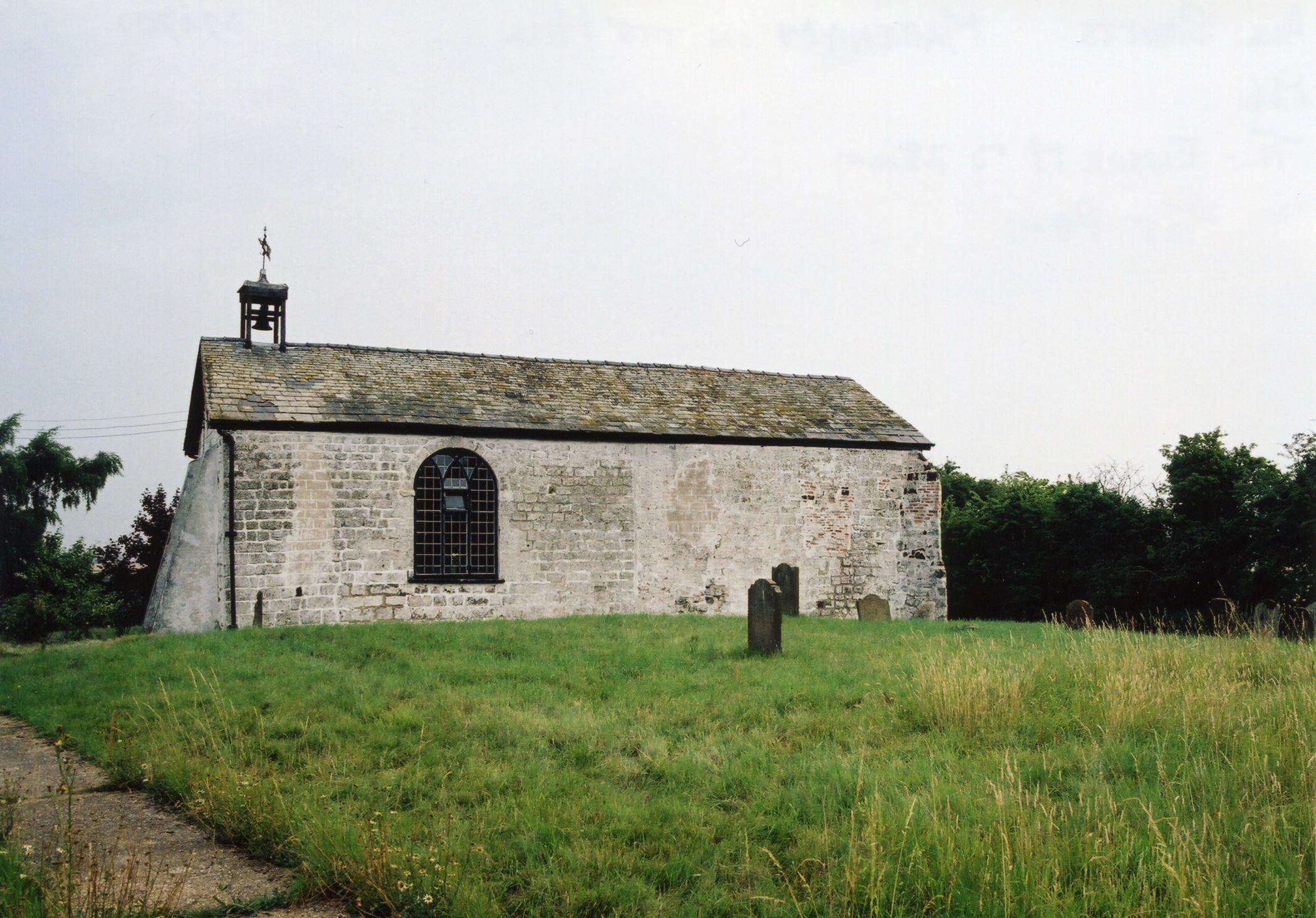
- The Anglican parish church is dedicated to All Saints.
- The church was built from local green sandstone.
- The church was restored in 1804.
- Circa 1806, a leather purse was found concealed in the wall, containing coins from the reigns of Edward IV and Henry the VII.
- The church seats 60.
- Richard CROFT has a photograph of All Saints Church on Geo-graph, taken in July, 2005.
- Here is a photograph of All Saints Church, taken by Ron COLE (who retains the copyright):
- The parish register reportedly dates from 1572, but the Bishop's transcripts go back to 1561.
- The LFHS has published several marriage and burial indexes for the Horncastle Deanery to make your search easier.
- The Wesleyan Methodists had a small chapel here built in 1853 to replace an earlier, smaller chapel.
- David HITCHBORNE has a photograph of the Former Wesleyan Chapel on Geo-graph, taken in September, 2007.
- For information and assistance in researching these chapels, see our non-conformist religions page.
- Check our Church Records page for county-wide resources.
- The parish was in the Tetford sub-district of the Horncastle Registration District.
- Check our Civil Registration page for sources and background on Civil Registration which started in July, 1837.
Mareham on the Hill is both a parish and a small village in the Wold hills, about 2.5 miles south-east of Horncastle and about 8 miles due east of Spilsby. High Toynton parish lies to the north, Scrivelsby parish to the south-west and Hammeringham parish to the south-east. The parish covered about 1,425 acres in 1842, but only 1,380 by 1872 due to the loss of a Fen allotment
The village is small. If you are planning a visit:
- See our touring page for visitor services.
- Ask for a calculation of the distance from Mareham on the Hill to another place.
- In 1842, the principal landowners were Christopher TURNER, the Rev. Richard WARD, the Hon. H. DYMOKE, Mrs. PARKINSON and several owners of small holdings.
- In 1872, the principal landowners were Christopher TURNER, Richard WARD, the Rev. Dr. PARKINSON and several owners of small holdings. The same is true in 1882.
- In 1900, the principal landowners were Edmund TURNER and Richard WARD.
- In 1913, the principal landowners were Christopher Hatton TURNER, Richard WARD and Francis NUNDY.
- See our Maps page for additional resources.
You can see maps centred on OS grid reference TF287678 (Lat/Lon: 53.191723, -0.075132), Mareham on the Hill which are provided by:
- OpenStreetMap
- Google Maps
- StreetMap (Current Ordnance Survey maps)
- Bing (was Multimap)
- Old Maps Online
- National Library of Scotland (Old Ordnance Survey maps)
- Vision of Britain (Click "Historical units & statistics" for administrative areas.)
- English Jurisdictions in 1851 (Unfortunately the LDS have removed the facility to enable us to specify a starting location, you will need to search yourself on their map.)
- Magic (Geographic information) (Click + on map if it doesn't show)
- GeoHack (Links to on-line maps and location specific services.)
- All places within the same township/parish shown on an Openstreetmap map.
- Nearby townships/parishes shown on an Openstreetmap map.
- Nearby places shown on an Openstreetmap map.
- The name derives from the Old English mere+inga+ham, meaning "settlement of dwellers by the pools". It appears as Meringhe in the 1086 Domesday Book and Marum around 1200.
[A. D. Mills, "A Dictionary of English Place-Names," Oxford University Press, 1991].
- White's 1842 Directory lists the following people in the parish: James ALLBONES, Henry ASTROP, Peter COLTON, Edward FROST, Zach. GOE, Samuel GOE, William MUMBY, William SCOTT, Samuel SORFLEET and Richard WINGATE.
- White's 1872 Directory lists the following surnames in the parish: AISTROP, BAGGALEY, BELL, COLTON, HUGHES, HURDMAN, NUNBY, SHAW, SORFLEET, STAMPER, SURR and WINGATE.
- White's 1882 Directory lists the following surnames in the parish: COLTON, ENGLISH, HOULT, HUGHES, HURDMAN, MARSHALL, NUNDY, SHAW, SMITH, SMITHSON, SORFLEET, STAMPER, SURR, TODD and WINGATE.
- Kelly's 1900 Directory lists the following people in the parish: William COLTON, Henry HOULT, Joseph HURDMAN, James and Emanuel MARSHALL, William NUNDY, Miss Sarah Jane SMITHSON, Edward SORFLEET, Henry TODD and Brown WINGATE.
- Kelly's 1913 Directory lists the following people in the parish: George & Harry HOULT, George & Harry HURDMAN, James MARSHALL, Francis NUNDY, Frederick PAUL, Miss Sarah J. SMITHSON, Tom THACKER, George TODD and Henry and Lowther WINGATE.
- This place was an ancient parish in Lincoln county and it became a modern Civil Parish when those were established.
- The parish was in the ancient Horncastle Soke in the East Lindsey district in the parts of Lindsey.
- For today's district governance, see the East Lindsey District Council.
- Bastardy cases would be heard in the Horncastle petty session hearings.
- As a result of the 1834 Poor Law Amendment Act, the parish became part of the Horncastle Poor Law Union.
- A National School was built here in 1874. Average attendance in 1900 was 30.
- For more on researching school records, see our Schools Research page.