
Hide
Ranby
hide
Hide
hide
Hide
hide
Hide
Hide
Hide
| St German, Ranby, Church of England |
- The parish was in the Wragby sub-district of the Horncastle Registration District.
- Check our Census Resource page for county-wide resources.
- The table below gives census piece numbers, where known:
| Census Year | Piece No. |
|---|---|
| 1841 | H.O. 107 / 642 |
| 1851 | H.O. 107 / 2107 |
| 1861 | R.G. 9 / 2365 |
| 1871 | R.G. 10 / 3379 |
| 1891 | R.G. 12 / 2597 |
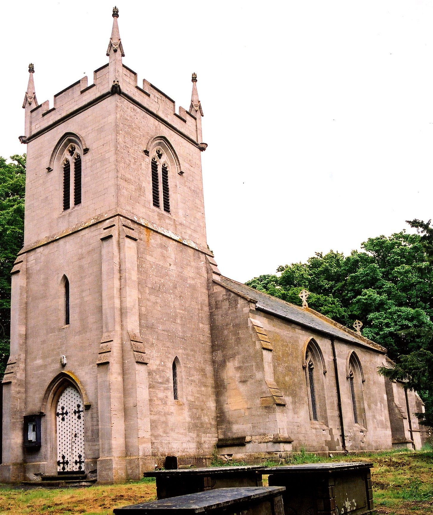
| St German, Ranby, Church of England |
- The Anglican parish church is dedicated to Saint German.
- The church was restored in 1860.
- The church seats 150.
- A photograph of Saint German's Church is at the Wendy PARKINSON English Church Photographs site.
- Here is a photo of Saint German's Church, taken by Ron COLE (who retains the copyrights).
- The Anglican parish register dates from 1550.
- The LFHS has published several marriage indexes for the Horncastle Deanery to make your search easier.
- Check our Church Records page for county-wide resources.
- The parish was in the Wragby sub-district of the Horncastle Registration District.
- Check our Civil Registration page for sources and background on Civil Registration which began in July, 1837.
Ranby is both a village and parish in the Wolds, bounded on the east by the River Bain. The parish sits about 7 miles north-west of Horncastle and 7.5 miles east from Wragby parish. The parish covers about 1,290 acres.
If you are planning a visit:
- See our touring page for more sources.
- Ask for a calculation of the distance from Ranby to another place.
- See our Maps page for additional resources.
You can see maps centred on OS grid reference TF231785 (Lat/Lon: 53.289437, -0.155096), Ranby which are provided by:
- OpenStreetMap
- Google Maps
- StreetMap (Current Ordnance Survey maps)
- Bing (was Multimap)
- Old Maps Online
- National Library of Scotland (Old Ordnance Survey maps)
- Vision of Britain (Click "Historical units & statistics" for administrative areas.)
- English Jurisdictions in 1851 (Unfortunately the LDS have removed the facility to enable us to specify a starting location, you will need to search yourself on their map.)
- Magic (Geographic information) (Click + on map if it doesn't show)
- GeoHack (Links to on-line maps and location specific services.)
- All places within the same township/parish shown on an Openstreetmap map.
- Nearby townships/parishes shown on an Openstreetmap map.
- Nearby places shown on an Openstreetmap map.
- The parish was in the North division of the ancient Gartree Wapentake in the East Lindsey district in the parts of Lindsey.
- For today's district governance, see the East Lindsey District Council.
- Bastardy cases would be held in the Horncastle petty session hearings every Saturday.
- As a result of the 1834 Poor Law Amendment Act, the parish became part of the Horncastle Poor Law Union on 16th January 1837.
- There was a School built here before 1900 to hold 104 children.
- For more on researching school records, see our Schools Research page.