
Hide
Stewton
hide
Hide
hide
Hide
hide
Hide
Hide
Hide
The nearby Library at Louth will prove useful in your research.
- The Lych Gate was built in 1903.
- Chris ? has a photograph of the Lych Gate at St. Andrew's Church on Geo-graph, taken in December, 2012.
- Steven FAREHAM has a photograph of an Open Lych Gate on Geo-graph, taken in October, 2015.
- Michael GARLICK has a photograph of the Churchyard on Geo-graph, taken in September, 2016.
- The parish was in the Louth sub-district of the Louth Registration District.
- Check our Census Resource page for county-wide resources.
- The table below gives census piece numbers, where known:
| Census Year | Piece No. |
|---|---|
| 1851 | H.O. 107 / 2111 |
| 1861 | R.G. 9 / 2383 |
| 1871 | R.G. 10 / 3404 |
| 1881 | R.G. 11 / 3263 |
| 1891 | R.G. 12 / 2608 |
| 1901 | R.G. 13 / 3084 |
| Stewton, Methodist (United Free) |
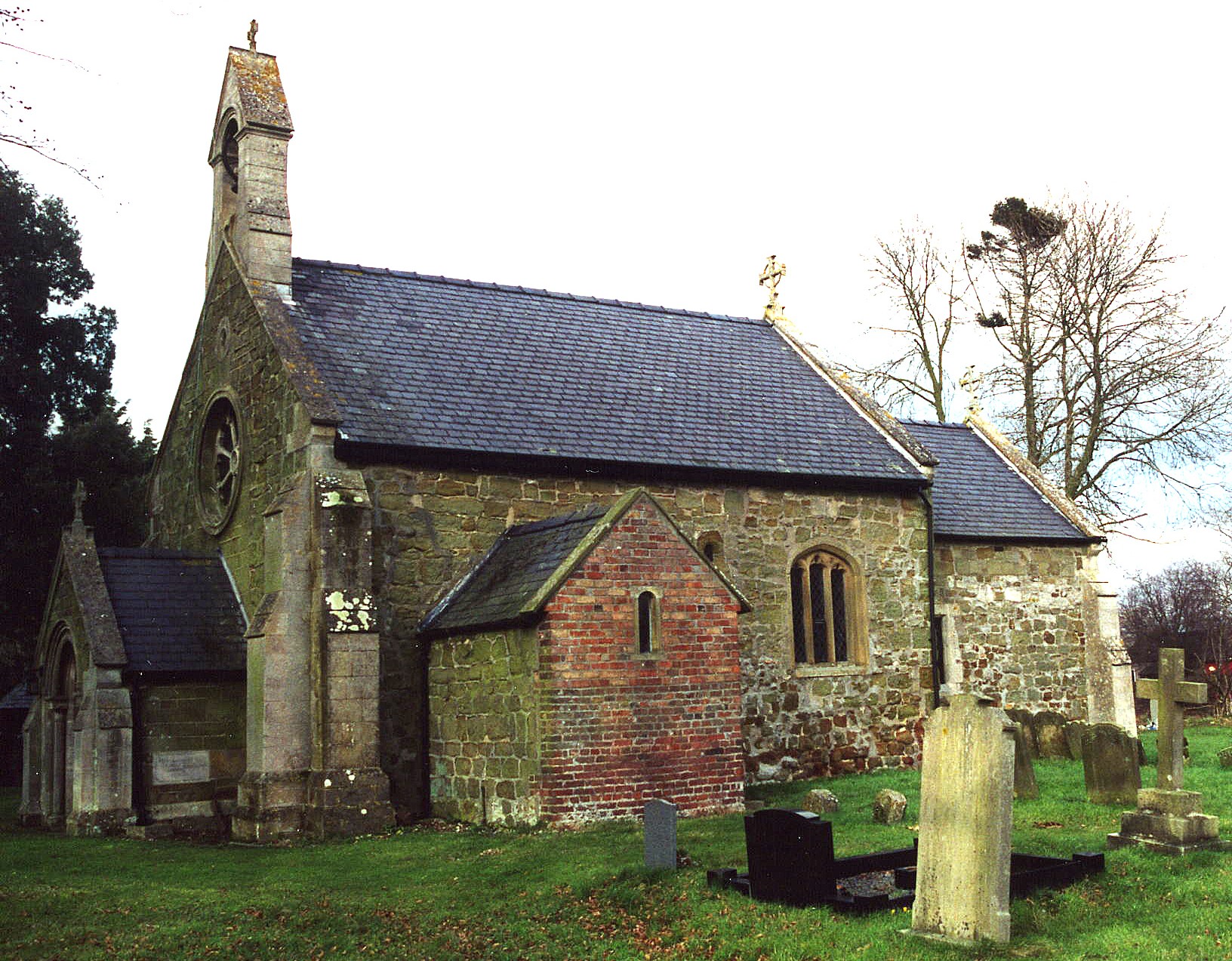
- The Anglican parish church is dedicated to Saint Andrew.
- The church is of Saxon and Early Norman origin.
- The church was built in the 11th century.
- The church was rebuilt in 1866.
- The church seats about 60.
- Jonathan THACKER has a view down Church Lane on Geo-graph, taken in June, 2011,
- There is a photograph of St. Andrew's church on the Wendy PARKINSON Church Photos web site.
- Here is a photo of St. Andrew's Church, taken by Ron COLE (who retains the copyright):
- The Anglican parish register dates from 1711 for baptisms and burials, and from 1756 for marriages.
- The Lincolnshire FHS has published several marriage indexes for the Louthesk Deanery to make your search easier.
- A United Methodist chapel was built here in 1861.
- Alex McGREGOR has a photograph of the former Methodist Chapel on Geo-graph, taken in August, 2014.
- For information and assistance in researching these chapels, see our non-conformist religions page.
- Check our Church Records page for county-wide resources.
- The parish was in the Louth sub-district of the Louth Registration District.
- Check our Civil Registration page for sources and background on Civil Registration which began in July, 1837.
Stewton is a village and a parish about 2 miles east of Louth in the Lincolnshire Wolds. The parish covers about 1,000 acres.
If you are planning a visit:
- Take the B1200 road east out of Louth and turn left after Bracken Hill. Or, alternatively, take Stewton Lane east out of Louth.
- See our touring page for more sources.
- Ask for a calculation of the distance from Stewton to another place.
- It is believed that there is a "disused Medieval Village" (DMV) just north of the existing hamlet of Stewton.
- Chris ? has a photograph of an old Hangar at the old airstrip on Geo-graph, taken in December, 2012.
- See our Maps page for additional resources.
You can see maps centred on OS grid reference TF362870 (Lat/Lon: 53.362282, 0.044804), Stewton which are provided by:
- OpenStreetMap
- Google Maps
- StreetMap (Current Ordnance Survey maps)
- Bing (was Multimap)
- Old Maps Online
- National Library of Scotland (Old Ordnance Survey maps)
- Vision of Britain (Click "Historical units & statistics" for administrative areas.)
- English Jurisdictions in 1851 (Unfortunately the LDS have removed the facility to enable us to specify a starting location, you will need to search yourself on their map.)
- Magic (Geographic information) (Click + on map if it doesn't show)
- GeoHack (Links to on-line maps and location specific services.)
- All places within the same township/parish shown on an Openstreetmap map.
- Nearby townships/parishes shown on an Openstreetmap map.
- Nearby places shown on an Openstreetmap map.
- This place was an ancient parish in Lincoln county and became a modern Civil Parish when those were established.
- The parish was in the Wold Division of the ancient Louth Eske Wapentake in the East Lindsey district of the parts of Lindsey.
- The parish is small enough to get by with just a Parish Meeting to deal with civil or political issues, and they do not have a formal Parish Council.
- For today's district governance, see the East Lindsey District Council.
- Bastardy cases would be heard in the Louth Eske petty session court every other Wednesday.
- As a result of the 1834 Poor Law Amendment Act reforms, the parish became part of the Louth Poorlaw Union.
- The children of this parish attended school at Grimoldby parish.
- For more on researching school records, see our Schools Research page.