
Hide
St Bartholomew by the Royal Exchange
hide
Hide
hide
Hide
Hide
Hide
"ST. BARTHOLOMEW, BY THE EXCHANGE, the church of, is situated at the south east corner of Bartholomew-lane and Threadneedle-street, near the north-east angle of the Bank of England. It was destroyed by the fire in 1666, all but the tower, which was cased and newly topped at the time of rebuilding the body of the church. This church is of very ancient foundation, for in the year 1331 John de Tyerne was presented to it, on the death of John de Aldeburgh, the rector, and it was then so entirely decayed that it was necessary to rebuild it. The living being at the time of the Reformation in the gift of the Abbey of St. Mary de Grace, it fell on the dissolution of the religious houses into the hands of the Crown, in whom the advowson, which is a rectory, has continued to the present time. The present rector is the Rev. George Shephard, D.D., preacher of Gray's-inn, who was instituted by the Lord Chancellor in 1807." [James Elmes. A Topographical Dictionary of London and its Environs (1831) - transcribed by Brian Randell]
Hide
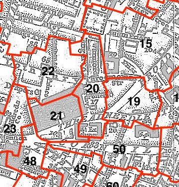
This parish - no. 20 in the above map - is located in Broad Street Ward.
The church was destroyed in 1666, rebuilt by Wren, demolished 1891 or 1902.
The parish was united with St. Christopher-le-Stocks, and lateeSt Margaret Lothbury 1839.
Hide
London Metropolitan Archive holdings for St Bartholomew by the Royal Exchange.
Online Parish Register Images and Indexes for St Bartholomew by the Royal Exchange parish are provided by, or at various subscription sites via, the LDS FamilySearch wiki.
Non-Church of England denominations identified in St Margaret Lothbury with St Christopher le Stocks and St Bartholomew by the Exchange include: Independent/Congregational and Presbyterian [LDS FamilySearch Wiki].
Freshfield, Edwin. On the parish books of St. Margaret-Lothbury, St. Christopher-le-Stocks, and St. Bartholomew-by-the-Exchange, in the city of London. London: Printed by J. B. Nichols and Sons (1876) 67pp. [Full text]
Wikipedia page on St Bartholomew by the Royal Exchange.
- Ask for a calculation of the distance from St Bartholomew by the Royal Exchange to another place.
Summary history of St Bartholomew by the Royal Exchange parish, from the Worshipful Company of Parish Clerks.
Public Houses, Inns & Taverns of the parish of St Bartholomew by the Royal Exchange - provides "information from census records, trade directories, etc."
Plan of the Parish of St Bartholomew by the Royal Exchange in 1795 from COLLAGE, the London Picture Archive.
You can see maps centred on OS grid reference TQ328812 (Lat/Lon: 51.51453, -0.087285), St Bartholomew by the Royal Exchange which are provided by:
- OpenStreetMap
- Google Maps
- StreetMap (Current Ordnance Survey maps)
- Bing (was Multimap)
- Old Maps Online
- National Library of Scotland (Old Ordnance Survey maps)
- Vision of Britain (Click "Historical units & statistics" for administrative areas.)
- English Jurisdictions in 1851 (Unfortunately the LDS have removed the facility to enable us to specify a starting location, you will need to search yourself on their map.)
- Magic (Geographic information) (Click + on map if it doesn't show)
- GeoHack (Links to on-line maps and location specific services.)
- All places within the same township/parish shown on an Openstreetmap map.
- Nearby townships/parishes shown on an Openstreetmap map.
- Nearby places shown on an Openstreetmap map.
Surnames from the 1881 census in the St Bartholomew By district.
Clerical career summaries for the parish of (i) St Bartholomew by the Royal Exchange and (ii) St Bartholomew the Great, from the Clergy of the Church of England Database website.
Sources for listings of taxpayer names for St Bartholomew by the Royal Exchange parish, listed on the LDS FamilySearch wiki.