
Hide
St Benet Sherehog
hide
Hide
hide
Hide
Hide
Hide
"ST. BENNETT'S, SHEREHOG, the church-yard of, is opposite to Size (formerly St. Sythe's) lane, on the south side of Pancras-lane, Bucklersbury. In the year 1323, it went by the name of St. Osyth's, subsequently corrupted to Sythes, and next to Size, from its being dedicated to a queen and martyr of that name. But she was divested of the tutelage of this church by Benedict Shorne, a fishmonger of London, who rebuilt and otherwise benefited it. He dedicated it to the saint whose name he bore, and his surname, being corrupted into Shrog, became, subsequently, Sherehog. The ancient church shared the fate of its neighbours in 1666, and not being rebuilt, was united by act of parliament to the parish of Stephen's, Walbrook." [James Elmes. A Topographical Dictionary of London and its Environs (1831) - transcribed by Brian Randell]
Hide
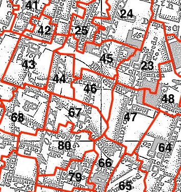
This parish - no. 46 in the above map - is located in Cheap Ward.
The church was destroyed in 1666 and not rebuilt.
The parish was later united with St Stephen Walbrook 1670.
Hide
London Metropolitan Archive holdings for St Benet Sherehog.
Online Parish Register Images and Indexes for St Benet Sherehog parish are provided by, or at various subscription sites via, the LDS FamilySearch wiki.
No non-Church of England denominations have been identified for St Stephen Walbrook with St Benet Sherehog [LDS FamilySearch Wiki].
Bannerman, William Bruce; Bannerman, William Bruce, jr (eds.). The registers of St. Stephen's, Walbrook, and of St. Benet Sherehog, London. London (1920) 208 pp. [Full text]
Wikipedia page on St Benet Sherehog.
- Ask for a calculation of the distance from St Benet Sherehog to another place.
Summary history of St Benet Sherehog parish, from the Worshipful Company of Parish Clerks.
Public Houses, Inns & Taverns of the parish of St Benet Sherehog - provides "information from census records, trade directories, etc."
You can see maps centred on OS grid reference TQ325811 (Lat/Lon: 51.513004, -0.091346), St Benet Sherehog which are provided by:
- OpenStreetMap
- Google Maps
- StreetMap (Current Ordnance Survey maps)
- Bing (was Multimap)
- Old Maps Online
- National Library of Scotland (Old Ordnance Survey maps)
- Vision of Britain (Click "Historical units & statistics" for administrative areas.)
- English Jurisdictions in 1851 (Unfortunately the LDS have removed the facility to enable us to specify a starting location, you will need to search yourself on their map.)
- Magic (Geographic information) (Click + on map if it doesn't show)
- GeoHack (Links to on-line maps and location specific services.)
- All places within the same township/parish shown on an Openstreetmap map.
- Nearby townships/parishes shown on an Openstreetmap map.
- Nearby places shown on an Openstreetmap map.
Surnames from the 1881 census in the St Benet Sherehog and St Benet Sherehog London districts.
Clerical career summaries for the parish of (i) St Benet Sherehog and (ii) St Stephen Walbrook With St Benet Sherehog, from the Clergy of the Church of England Database website.
Sources for listings of taxpayer names for St Benet Sherehog parish, listed on the LDS FamilySearch wiki.