
Hide
St Lawrence Jewry
hide
Hide
hide
Hide
Hide
Hide
"ST. LAWRENCE, Jewry. The church of, is situated at the south-west corner of Guildhall-yard and Cateaton-street. It derives its name as being dedicated to St. Lawrence, a Spanish saint, who was broiled alive upon a gridiron, in the reign of the Emperor Valerian, and its addition from its situation near the Jewry. The ancient church on this site was a rectory, which being given by Henry de Wickenbroke to Baliol College, in 1294, the rectory ceased, and Richard, Bishop of London, converted it into a vicarage, and the patronage still continues with the Master and Scholars of that college. It was destroyed by the great fire of 166G, and was rebuilt by Sir Christopher Wren, at the expense of the parishioners, assisted by a very liberal benefaction by Sir John Langham. The parish of St. Mary, Magdalen, Milk-street, was united to it by an act of parliament, and the church was finished in 1676. . . . The advowson of this church is a vicarage, and that of its sister parish of St. Mary Magdalen, Milk-street, is a rectory, and the patronage is alternately with Baliol College and the Dean and Chapter of St. Paul's. It is in the city and archdeaconry of London, and the present incumbent is the Rev. Allatson Burgh, who was instituted by the Dean and Chapter, whose turn it was, in 1815." [James Elmes. A Topographical Dictionary of London and its Environs (1831) - transcribed by Brian Randell]
Hide
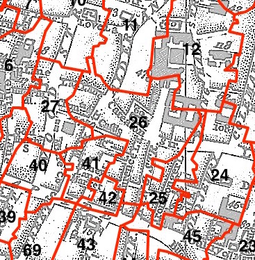
This parish - no. 26 in the above map - is located in Cheap Ward.
The church was built by Wren in 1670-87.
Hide
London Metropolitan Archive holdings for St Lawrence Jewry.
A History of the Church - provided on the St Lawrence Jewry website.
Online Parish Register Images and Indexes for St Lawrence Jewry parish are provided by, or at various subscription sites via, the LDS FamilySearch wiki.
No non-Church of England denominations have been identified for St Lawrence Jewry with St Mary Magdalene Milk Street [LDS FamilySearch Wiki].
Wikipedia page on St Lawrence Jewry.
- Ask for a calculation of the distance from St Lawrence Jewry to another place.
Summary history of St Lawrence Jewry parish, from the Worshipful Company of Parish Clerks (in preparation).
Public Houses, Inns & Taverns of the parish of St Lawrence Jewry - provides "information from census records, trade directories, etc."
Plan of the Parish of St Lawrence Jewry in 1862 from COLLAGE, the London Picture Archive.
You can see maps centred on OS grid reference TQ324813 (Lat/Lon: 51.515104, -0.092601), St Lawrence Jewry which are provided by:
- OpenStreetMap
- Google Maps
- StreetMap (Current Ordnance Survey maps)
- Bing (was Multimap)
- Old Maps Online
- National Library of Scotland (Old Ordnance Survey maps)
- Vision of Britain (Click "Historical units & statistics" for administrative areas.)
- English Jurisdictions in 1851 (Unfortunately the LDS have removed the facility to enable us to specify a starting location, you will need to search yourself on their map.)
- Magic (Geographic information) (Click + on map if it doesn't show)
- GeoHack (Links to on-line maps and location specific services.)
- All places within the same township/parish shown on an Openstreetmap map.
- Nearby townships/parishes shown on an Openstreetmap map.
- Nearby places shown on an Openstreetmap map.
Surnames from the 1881 census in the St Lawrence Jewry and St Lawrence Jewry London districts.
Clerical career summaries for the parish of (i) St Lawrence Jewry and (ii) St Lawrence Jewry With St Mary Magdalene Milk Street, from the Clergy of the Church of England Database website.
A brief report on the parish workhouse is given in City of London Parish Workhouses.
Sources for listings of taxpayer names for St Lawrence Jewry parish, listed on the LDS FamilySearch wiki.