
Hide
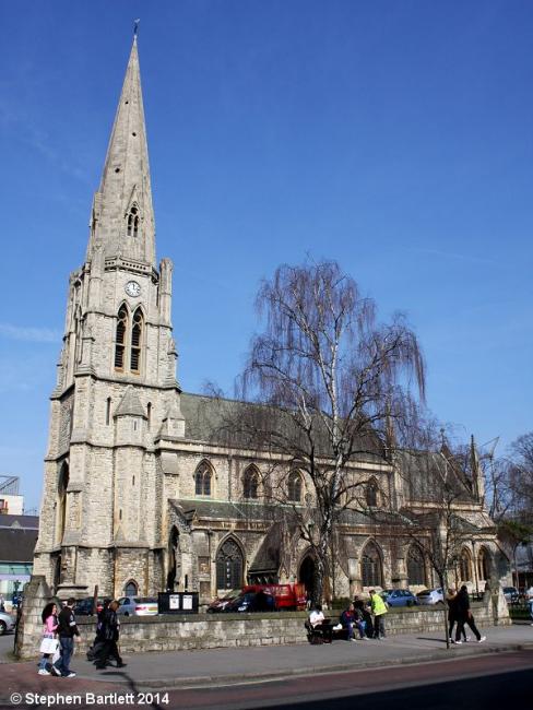
Christ the Saviour (1852-1951, Christ Church), Ealing, Church of England
hide
Hide
Hide
Hide
It was founded in 1852.
The address of Christ the Saviour is ?New Broadway?. It was consecrated (as ?Christ Church?) in 1852 (according to its own website) and the 1894 Godfrey map of the area shows it and the next-door parsonage (now demolished) standing on the constricted corner site where the church alone now stands. It is unlikely to have had a graveyard. [Based on information supplied by Stephen Bartlett, March 2014.]
It is located at TQ1770180754 (Lat/Lon 51.513461, -0.305215). You can see this on maps provided by:
- OpenStreetMap
- Google Maps
- StreetMap (Current Ordnance Survey maps)
- Bing (was Multimap)
- Old Maps Online
- National Library of Scotland (Old Ordnance Survey maps)
- Vision of Britain (Click "Historical units & statistics" for administrative areas.)
- English Jurisdictions in 1851 (Unfortunately the LDS have removed the facility to enable us to specify a starting location, you will need to search yourself on their map.)
- Magic (Geographic information) (Click + on map if it doesn't show)
- GeoHack (Links to on-line maps and location specific services.)