
Hide
Bamburgh
hide
Hide
hide
Hide
Hide
Hide
"BAMBROUGH is a parish, comprising two chapelries and twenty-two townships, and is about eight miles long by six broad. It occupies the whole breadth of the ward from Budle Bay and Belford, to Beadnel and Ellingham, and comprises an area of 26,234 acres. Its population in 1801, was 2,935; in 1811, 3,114; in 1821, 3,342; in 1831, 3,949; in 1841, 4,237; and in 1851, 4,545 souls." [From History, Topography, and Directory of Northumberland, Whellan, 1855].
"BAMBROUGH, a parish in the ...... county of NORTHUMBERLAND, comprising the chapelries of Beadnell and Lucker, and the townships of Adderstone, Bambrough, Bambrouga- Castle', Bradford, Budle, Burton, Elford, Fleetham, Glororum, Hoppen, Mouson, Newham, Newstead, Outchester, Ratchwood, Shoston, Spindlestone, North Sunderland, Swinhoe, Tuggal, Warrenton, and Warnford,........." [Samuel Lewis Topographical Dictionary of England 1831 © Mel Lockie]
Included in the parish registers is North Sunderland
Hide
- Burial Registers 1886-1954 for North Sunderland Civil Cemetery are available at Northumberland Record Office
- The 1851 Census Index (microfiche CN28) Belford and Bamburgh (PRO piece HO107/2420 folios 1-250) (Type B) (Book) published by the https://www.ndfhs.org.uk/ may be of value to researchers interested in this parish.
- Northumberland Record Office hold Census returns 1841 - 1891 and produce a useful User Guide
- A list of ships and crews in port during the 1881 census provided by Bob Sanders.
- The Ancestral Indexes website provides information about North Sunderland, St Paul.
- Bamburgh - Church Records - links and information.
- Full transcriptions of the Bishops Transcripts for Bambrough 1762 to 1837 and North Sunderland Baptisms Marriages and Burials can be found using the link below, please scroll down the list to the relevant parish
- https://northumberlandparishregistertranscriptslocalhistory.wordpress.com/
- This area is within Northumberland North First Registration District.
- Certificates of birth, death and marriage can be ordered from Northumberland County Council.
- Bamburgh - Description and Travel - links and information.
- The North Sunderland Railway operated by North Eastern railway Co opened in 1898 and ran between Chathill and Seahouses the line closed in 1951
- The section of The National Gazetteer (1868) relating to this parish - transcribed by Colin Hinson.
- Ask for a calculation of the distance from Bamburgh to another place.
- The history of Bamburgh Parish is included in:- Northumberland County History Committee, History of Northumberland, Volume 1. Newcastle, A. Reid, 1893.
- Photographs of Bamburgh Castle and Grace Darling's Memorial at Bamburgh supplied by George Bell.
- Bamburgh - Maps - links and information
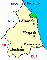
You can see maps centred on OS grid reference NU164305 (Lat/Lon: 55.567683, -1.741205), Bamburgh which are provided by:
- OpenStreetMap
- Google Maps
- StreetMap (Current Ordnance Survey maps)
- Bing (was Multimap)
- Old Maps Online
- National Library of Scotland (Old Ordnance Survey maps)
- Vision of Britain (Click "Historical units & statistics" for administrative areas.)
- English Jurisdictions in 1851 (Unfortunately the LDS have removed the facility to enable us to specify a starting location, you will need to search yourself on their map.)
- Magic (Geographic information) (Click + on map if it doesn't show)
- GeoHack (Links to on-line maps and location specific services.)
- All places within the same township/parish shown on an Openstreetmap map.
- Nearby townships/parishes shown on an Openstreetmap map.
- Nearby places shown on an Openstreetmap map.
LEST WE FORGET - North Sunderland Cemetery
24 August 1921 William Hunter Greener age 29 Flight Sgt 200501 RAF HM Airship R 308 son of William and Margaret Ann Greener of Newsham Road, Blyth. [grave N18]