
Hide
Bothal
hide
Hide
hide
Hide
Hide
Hide
"BOTHAL parish comprises the townships of Ashington and Sheepwash. Bothal Demesne, Longhirst, Oldmoor, and Pegsworth, whose united area is 7,593 acres. The population in 1801, was 622; in 1811, 557; in 1821, 658; in 1831, 755; in 1841, 800; and in 1851, 946 souls. This parish is about three miles in length, by the same in breadth, and is bounded by the parishes of Woodhorm, Ulgham, Hebron and Morpeth; as also by the river Wansbeck, which separates it from Bedlingtonshire." [From History, Topography, and Directory of Northumberland, Whellan, 1855].
Hide
- The 1851 Census Index (microfiche CN24) published by the Northumberland and Durham Family History Society may be of value to researchers interested in this parish.
- St Andrew's Church, Bothal was built possibly about 882 and enlarged about 1150. Most of the present building, however, dates from the thirteenth and fourteenth centuries. It is situated near the castle in Bothal village, between Ashington and Morpeth.
Two parishes were subsequently taken out of Bothal parish: Longhirst, St John the Evangelist, in 1876, and Ashington, Holy Sepulchre. in 1887. - The Ancestral Indexes website provides information about Ashington, Holy Sepulchre and Longhirst, St John.
- Bothal - Church Records - links and information.
- This area is within Northumberland Central Registration District.
- Certificates of birth, death and marriage can be ordered from Northumberland County Council.
Order Certificates.
- Photographs of Bothal and Sheepwash from Les Bell's Northumberland Cam website.
- The Northumberland Communities website includes pages relating to Ashington and Pegswood. They provide "a range of learning resource material that reflects Northumberland's heritage, providing a base for studying the County's history. The website provides a starting point for understanding the development of communities in Northumberland. It also seeks to illustrate the range of sources for family and local history research that are available via Northumberland Archives Service."
- The section of The National Gazetteer (1868) relating to this parish - transcribed by Colin Hinson.
- Ask for a calculation of the distance from Bothal to another place.
- The history of Bothal Parish is included in:- Hodgson, J., History of Northumberland, Part 2, Volume 2. Newcastle, 1832. (Available on fiche from Ancestral Indexes).
- Bothal - Maps - links and information.
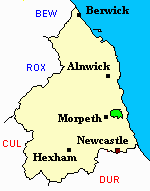
You can see maps centred on OS grid reference NZ241883 (Lat/Lon: 55.187974, -1.623187), Bothal which are provided by:
- OpenStreetMap
- Google Maps
- StreetMap (Current Ordnance Survey maps)
- Bing (was Multimap)
- Old Maps Online
- National Library of Scotland (Old Ordnance Survey maps)
- Vision of Britain (Click "Historical units & statistics" for administrative areas.)
- English Jurisdictions in 1851 (Unfortunately the LDS have removed the facility to enable us to specify a starting location, you will need to search yourself on their map.)
- Magic (Geographic information) (Click + on map if it doesn't show)
- GeoHack (Links to on-line maps and location specific services.)
- All places within the same township/parish shown on an Openstreetmap map.
- Nearby townships/parishes shown on an Openstreetmap map.
- Nearby places shown on an Openstreetmap map.
- Bothal Parish was part of Morpeth Poor Law Union. The Union Workhouse was located in Newgate Street, Morpeth. Some records are held at Northumberland Archives Service, but these are of limited genealogical value.
- Peter Higginbotham has provided details, a map and photograph of Morpeth Workhouse.