
Hide
Corsenside
hide
Hide
hide
Hide
Hide
Hide
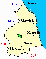
"CORSENSIDE parish is bounded by Bellingham, Elsdon, Kirkwhelpington, and Chollerton, and is intersected by the river Reed. It is about six miles long by four and a half broad, and comprises an area of 11,132 acres; rateable value £6,193 10s. The population in 1801, was 375; in 1811, 424; in 1821, 487; in 1831, 524; in 1841, in consequence of the prosperous state of the ironworks, it had increased to 1,108; and in 1851, the stoppage of the same works reduced the population to 579 souls, half the inhabitants having left the parish. The land on the eeast and west sides of this district, are bleak, moorish, and sterile, but near the river the soil is of a light gravelly nature, and produces abundant crops of grass and corn. Both coal and limestone are found here. This parish is not divided into townships, but it is separated into three portions called constablewicks." [From History, Topography, and Directory of Northumberland, Whellan, 1855].
Hide
- The 1851 Census Index (microfiche CN20) published by the Northumberland and Durham Family History Society may be of value to researchers interested in this parish.
- The Ancestral Indexes website provides information about West Woodburn, All Saints.
- Corsenside - Church Records - links and information.
- This area is within Northumberland West Registration District.
- Certificates of birth, death and marriage can be ordered from Northumberland County Council.
Order Certificates.
- The section of The National Gazetteer (1868) relating to this parish - transcribed by Colin Hinson.
- Ask for a calculation of the distance from Corsenside to another place.
- The history of Corsenside Parish is included in:- Hodgson, J., History of Northumberland, Part 2, Volume 1. Newcastle, 1827. (Available on fiche from Ancestral Indexes).
- Maps of locations in this parish provided by Streetmap.
Chesterhope, Corsenside, East Woodburn, Ridsdale, West Woodburn.
You can see maps centred on OS grid reference NY901866 (Lat/Lon: 55.173799, -2.157526), Corsenside which are provided by:
- OpenStreetMap
- Google Maps
- StreetMap (Current Ordnance Survey maps)
- Bing (was Multimap)
- Old Maps Online
- National Library of Scotland (Old Ordnance Survey maps)
- Vision of Britain (Click "Historical units & statistics" for administrative areas.)
- English Jurisdictions in 1851 (Unfortunately the LDS have removed the facility to enable us to specify a starting location, you will need to search yourself on their map.)
- Magic (Geographic information) (Click + on map if it doesn't show)
- GeoHack (Links to on-line maps and location specific services.)
- All places within the same township/parish shown on an Openstreetmap map.
- Nearby townships/parishes shown on an Openstreetmap map.
- Nearby places shown on an Openstreetmap map.
- Corsenside Parish was part of Bellingham Poor Law Union. The Union Workhouse was located in the town of Bellingham. Some records are held at Northumberland Archives Service, but these are of limited genealogical value.
- Peter Higginbotham has provided details, a map and photographs of Bellingham Workhouse.