
Hide
Cramlington
hide
Hide
hide
Hide
Hide
Hide
"CRAMLINGTON PAROCHIAL CHAPELRY. This chapelry, forming a portion of the Parish of St Andrew, Newcastle, is bounded on the north by Horton, on the west by Stannington, on the south by Long Benton, and on the east by Earsdon, and comprises an area of 3,492 acres. The number of its inhabitants in 1801, was 271; in 1811, 303: in l821, 330; in 1831, 931; in 1841, 2,634; and in 1851, it had increased to 3,367 souls." [From History, Topography, and Directory of Northumberland, Whellan, 1855]
Hide
- The 1851 Census Index (microfiche CN13) published by the Northumberland and Durham Family History Society may be of value to researchers interested in this area.
- Cramlington was a chapelry within Newcastle, St Andrew's Parish. The chapel was dedicated to St Nicholas and may have been built as early as 1270. The present church of Cramlington, St Nicholas was built in 1868 to serve the rapidly increasing population resulting from the growth of coal mining. The coal mines are now closed, and the church serves the population of Cramlington New Town.
- Cramlington - Church Records - links and information.
- This area is within Northumberland Central Registration District.
- Certificates of birth, death and marriage can be ordered from Northumberland County Council.
Order Certificates.
- The Northumberland Communities website includes pages relating to Cramlington. They provide "a range of learning resource material that reflects Northumberland's heritage, providing a base for studying the County's history. The website provides a starting point for understanding the development of communities in Northumberland. It also seeks to illustrate the range of sources for family and local history research that are available via Northumberland Archives Service."
- The section of The National Gazetteer (1868) relating to this parish - transcribed by Colin Hinson.
- Ask for a calculation of the distance from Cramlington to another place.
- The history of Cramlington Parochial Chapelry is included in:- Northumberland County History Committee, History of Northumberland, Volume 13. Newcastle, A. Reid, 1930. (Available on fiche from Ancestral Indexes).
- Cramlington - Maps - links and information.
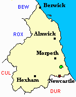
You can see maps centred on OS grid reference NZ266765 (Lat/Lon: 55.08261, -1.585206), Cramlington which are provided by:
- OpenStreetMap
- Google Maps
- StreetMap (Current Ordnance Survey maps)
- Bing (was Multimap)
- Old Maps Online
- National Library of Scotland (Old Ordnance Survey maps)
- Vision of Britain (Click "Historical units & statistics" for administrative areas.)
- English Jurisdictions in 1851 (Unfortunately the LDS have removed the facility to enable us to specify a starting location, you will need to search yourself on their map.)
- Magic (Geographic information) (Click + on map if it doesn't show)
- GeoHack (Links to on-line maps and location specific services.)
- All places within the same township/parish shown on an Openstreetmap map.
- Nearby townships/parishes shown on an Openstreetmap map.
- Nearby places shown on an Openstreetmap map.
- The Cramlington Strike of 1865 - an extract from "The Miners of Northumberland and Durham" by Richard Fynes (1873).
- Cramlington Chapelry was part of Tynemouth Poor Law Union. The Union Workhouse was located in Preston Lane, North Shields. Some useful records are held at Tyne and Wear Archives Service.
- Peter Higginbotham has provided details, a map, plan and photograph of Tynemouth Workhouse.