
Hide
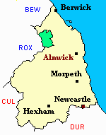
Kirknewton
hide
Hide
hide
Hide
Hide
Hide
"KIRKNEWTON parish is bounded on the north by the parishes of Ford, Carham, and Branxton, on the west by Scotland, on tbe south by Coquetdale Ward, and on the east by Doddington and Wooler parishes. It comprises the townships of Akeld, Coldsmouth and Thompson's Walls, Coupland, Crookhouse, Grey's Forest, Heathpool, Howtell, Kilham, Kirk Newton, Lanton, Milfield, Newton West, Paston, Selby's Forest, and Yeavering, whose united area is 37,976 acres. Its population in 1801, was 1,406; in 1811, 1,472; in 1821, 1,701; in 1831, 1,674; in 1841, 1,726; and in 1851, 1,732 souls. The principal landowners are Sir William Davison, Sir F. Blake. Matthew Culley, Esq., George A. Grey, Esq., the Earl of Tankerville, ---- Morton, Esq., Percival Clennell, Esq., George Rea. Esq., Frank Sitwell, Esq., Lady Stanley, Johu Ord, Esq., Alexander Thompson, Esq., and Robert Thompson, Esq. This parish occupies an extensive but thinly populated tract, in the south-western part of Glendale Ward." [From History, Topography, and Directory of Northumberland, Whellan, 1855].
Hide
- Northumberland County Record Office holds copies of Census Returns 1841 - 1891 and provides a useful User Guide
- The 1851 Census Index (microfiche CN34 and CN35) published by the Northumberland and Durham Family History Society may be of value to researchers interested in this parish.
- 1891Census Northumberland – Ford (Carham, Wark, Downham, Presson, Branxton, Ford, Etal and New Etal, Crookham, Kimmerston, Berryhill, Lowick, Bowsden, Barmoor, Holburn, Millfield, Crookhouse, Lanton, Coupland, Coupland, Howtell, Kilham, Paston, Coldsmouth and Thompsons Wall, Kirknewton, Westnewton, Yeavering, Hethpool and Greys Forest) (PRO piece RG12/4270) (Type B) (Book) (Volume 80) published by the Northumberland and Durham Family History Society may be of value to researchers interested in this parish.
- Kirknewton - Church Records - links and information.
- This area is within Northumberland North First Registration District.
- Certificates of birth, death and marriage can be ordered Locally from Northumberland County Council.
- Photographs of College Valley and Trowupburn from Les Bell's Northumberland Cam website.
- The Northumberland Communities website includes pages relating to Howtel, Kirknewton and Milfield. They provide "a range of learning resource material that reflects Northumberland's heritage, providing a base for studying the County's history. The website provides a starting point for understanding the development of communities in Northumberland. It also seeks to illustrate the range of sources for family and local history research that are available via Northumberland Archives Service."
- The section of The National Gazetteer (1868) relating to this parish - transcribed by Colin Hinson.
- Ask for a calculation of the distance from Kirknewton to another place.
- A history of the village of Kirknewton from the Northumberland National Park website.
- A history of the village of Akeld from the Northumberland National Park website.
- A history of the village of Hethpool from the Northumberland National Park website.
- A history of the village of Kilham from the Northumberland National Park website.
- A history of the village of Westnewton from the Northumberland National Park website.
- The history of Kirknewton Parish is included in:- Northumberland County History Committee, History of Northumberland, Volume 11. Newcastle, A. Reid, 1922.
- Kirknewton - Maps - links and information.
You can see maps centred on OS grid reference NT902269 (Lat/Lon: 55.535598, -2.156969), Kirknewton which are provided by:
- OpenStreetMap
- Google Maps
- StreetMap (Current Ordnance Survey maps)
- Bing (was Multimap)
- Old Maps Online
- National Library of Scotland (Old Ordnance Survey maps)
- Vision of Britain (Click "Historical units & statistics" for administrative areas.)
- English Jurisdictions in 1851 (Unfortunately the LDS have removed the facility to enable us to specify a starting location, you will need to search yourself on their map.)
- Magic (Geographic information) (Click + on map if it doesn't show)
- GeoHack (Links to on-line maps and location specific services.)
- All places within the same township/parish shown on an Openstreetmap map.
- Nearby townships/parishes shown on an Openstreetmap map.
- Nearby places shown on an Openstreetmap map.