
Hide
Newburn
hide
Hide
hide
Hide
Hide
Hide
"NEWBURN, a parish in the west division of Castle Ward, and east division of Tindale Ward, is bounded on the north by Ponteland parish, on the west by Tindale Ward and Heddon-on-the-Wall, on the south by the river Tyne, and on the east by the parishes of Gosforth and St. John. It contains 11,566 acres, and the number of its inhabitants in 1801, was 4,142; in 1811, 3,993; in 1821, 4,166; in 1831, 4,582; in 1841, 4,156; and in 1851, 4,316 souls. This parish includes the townships of Black Callerton, Butterlaw, Dalton, East Denton, West Denton, North Dissington, South Dissington, Newbiggin, Newburn, Newburn Hall, Sugley, Throckley, Walbottle, and Whorlton East and West. A small portion of the township of Black Callerton, in the parish of Ponteland, containing two houses and nine persons in 1851, belongs to this parish. The Bishop of Carlisle is the owner of the tithes. This is a very fertile district, with a varied and beautiful surface. On the banks of the Tyne, in this parish, there are extensive iron works, coal staiths, brick and tile yards, chemical works, and other manufactories of various kinds." [From History, Topography, and Directory of Northumberland, Whellan, 1855].
Hide
- The 1851 Census Index (microfiche CN14) published by the https://www.ndfhs.org.uk/ may be of value to researchers interested in this parish.
- The Ancestral Indexes website provides information about Blucher, St Cuthbert, Dalton, Holy Trinity, Sugley, Holy Saviour, Throckley, St Mary and Whorlton, St John.
- Newburn - Church Records - links and information.
- This area is within Newcastle upon Tyne Registration District
- Certificates of birth, death and marriage can be ordered by post.
Information. Searches.
- Pooh-Bah of Colliery at Westerhope - an article about Callerton Colliery at Westerhope in 1931.
- The section of The National Gazetteer (1868) relating to this parish - transcribed by Colin Hinson.
- Ask for a calculation of the distance from Newburn to another place.
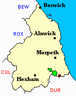
- A map showing the Townships in Newburn Parish.
- The history of Newburn Parish is included in:- Northumberland County History Committee, History of Northumberland, Volume 13. Newcastle, A. Reid, 1930. (Available on fiche from Ancestral Indexes).
- Newburn - Maps - links and information.
You can see maps centred on OS grid reference NZ149693 (Lat/Lon: 55.018124, -1.767854), Newburn which are provided by:
- OpenStreetMap
- Google Maps
- StreetMap (Current Ordnance Survey maps)
- Bing (was Multimap)
- Old Maps Online
- National Library of Scotland (Old Ordnance Survey maps)
- Vision of Britain (Click "Historical units & statistics" for administrative areas.)
- English Jurisdictions in 1851 (Unfortunately the LDS have removed the facility to enable us to specify a starting location, you will need to search yourself on their map.)
- Magic (Geographic information) (Click + on map if it doesn't show)
- GeoHack (Links to on-line maps and location specific services.)
- All places within the same township/parish shown on an Openstreetmap map.
- Nearby townships/parishes shown on an Openstreetmap map.
- Nearby places shown on an Openstreetmap map.
- A transcript of Throckley War Memorial provided by Ancestral Indexes.