
Hide
Ponteland
hide
Hide
hide
Hide
Hide
Hide
"PONTELAND is a parish comprising the townships of Berwick Hill, Callerton (High), Callerton (Little), Coldcoats, Darras Hall, Higham Dykes, Kirkley, Milburn, Milburn Grange, and Ponteland, whose united area amounts to 10,073 acres. It is bounded on the north by Whalton and Stannington parishes, on the west by Newburn, Stamfordham, and Whalton parishes, on the south by Newburn parish, and on the east by the parish of Gosforth. The population in 1801, was 936; in 1811, 943; in 1821, 934; in 1831, 1,034; in 1841, 1,094; and in 1851, it had increased to 1,137 souls. The soil of this parish is rich and strong, yeilding good wheat crops and excellent pasturage. Large quantities of lime and coal are found in this district." [From History, Topography, and Directory of Northumberland, Whellan, 1855].
Hide
- Ponteland , Images of England series compiled by John Turner 1999
- Ponteland through the twentieth Century - Ponteland Local History Society Leslie Almon
- Ponteland Bowling Club Past and Present B D W Wright
Helen Bailey - Author, although born in Newcastle was brought up in Ponteland and attended Ponteland High School, which inspired her Electra brown stories Helen died 15 July 2016
- Northumberlnd County Record Office holds Census Returns 1841 - 1891 and provides a useful User Guide
- The 1851 Census Index (microfiche CN14) Ponteland (PRO piece HO107/2413 folios 1-238) (Type A) (Book)
- 1891 Census Ponteland 1A (Ponteland, High and Little Callerton, Darras Hall, Coldcoats, Milbourne, Belsay, Whalton, Ogle, Twizell, Shilvington, part of Stannington, North and South Gosforth and Coxlodge) (PRO piece RG12/4240) (Type B) (Book) (Volume 50)
- 1891 Census Ponteland 1B (Coxlodge, Fawdon, East and West Brunton, Kenton, Dinnington, Mason, Brenkley, Prestwick, Woolsington, Horton Grange, Kirley and Berwick Hill) (PRO piece RG12/4241) (Type B) (Book) (Volume 51) All published by thehttps://www.ndfhs.org.uk/ may be of value to researchers interested in this parish.
- The Ancestral Indexes website provides information about Brunswick Village, St Cuthbert and Dinnington, St Matthew.
- Ponteland - Church Records - links and information.
- This area is divided between Northumberland Central Registration District and Newcastle upon Tyne Registration District.
- Certificates can be ordered from Northumberland County Council
- Newcastle - Information. Searches.
- The Northumberland Communities website includes pages relating to Ponteland. They provide "a range of learning resource material that reflects Northumberland's heritage, providing a base for studying the County's history. The website provides a starting point for understanding the development of communities in Northumberland. It also seeks to illustrate the range of sources for family and local history research that are available via Northumberland Archives Service."
- The section of The National Gazetteer (1868) relating to this parish - transcribed by Colin Hinson.
- Ask for a calculation of the distance from Ponteland to another place.
- The history of Ponteland Parish is included in:- Northumberland County History Committee, History of Northumberland, Volume 12. Newcastle, A. Reid, 1926. (Available on fiche from Ancestral Indexes).
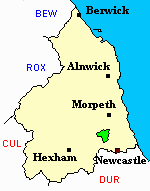
- Ponteland - Maps - links and information.
You can see maps centred on OS grid reference NZ146734 (Lat/Lon: 55.054804, -1.773219), Ponteland which are provided by:
- OpenStreetMap
- Google Maps
- StreetMap (Current Ordnance Survey maps)
- Bing (was Multimap)
- Old Maps Online
- National Library of Scotland (Old Ordnance Survey maps)
- Vision of Britain (Click "Historical units & statistics" for administrative areas.)
- English Jurisdictions in 1851 (Unfortunately the LDS have removed the facility to enable us to specify a starting location, you will need to search yourself on their map.)
- Magic (Geographic information) (Click + on map if it doesn't show)
- GeoHack (Links to on-line maps and location specific services.)
- All places within the same township/parish shown on an Openstreetmap map.
- Nearby townships/parishes shown on an Openstreetmap map.
- Nearby places shown on an Openstreetmap map.