
Hide
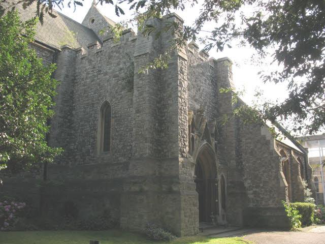
St Catherine, Hatcham, New Cross, Church of England
hide
Hide
© Copyright Stephen Craven and licensed for reuse under this Creative Commons Licence.
Hide
St Catherine,
102a Pepys Road,
Hatcham, New Cross
Hide
The original church building (see https://www.genuki.org.uk/big/eng/SRY/Deptford/StCatherine1) was destroyed by fire on 6 May 1913, allegedly arson by suffragettes. This is the rebuilt church “with a larger chancel”, although this was badly damaged in World War II.
It is located at TQ3593576107 (Lat/Lon 51.467612, -0.044398). You can see this on maps provided by:
- OpenStreetMap
- Google Maps
- StreetMap (Current Ordnance Survey maps)
- Bing (was Multimap)
- Old Maps Online
- National Library of Scotland (Old Ordnance Survey maps)
- Vision of Britain (Click "Historical units & statistics" for administrative areas.)
- English Jurisdictions in 1851 (Unfortunately the LDS have removed the facility to enable us to specify a starting location, you will need to search yourself on their map.)
- Magic (Geographic information) (Click + on map if it doesn't show)
- GeoHack (Links to on-line maps and location specific services.)