
Hide
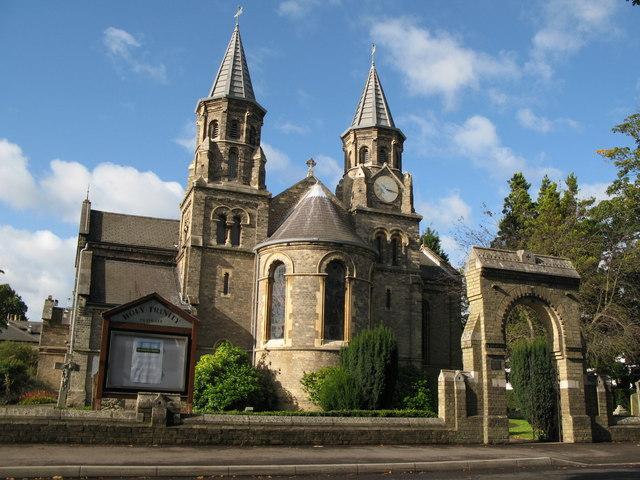
Holy Trinity, Claygate, Church of England
hide
Hide
© Copyright Mike Quinn and licensed for reuse under this Creative Commons Licence.
Hide
Holy Trinity,
Church Road,
Claygate
Hide
The present building was consecrated on 22 December 1840 as an additional church in the parish of Thames Ditton.
The church has/had a graveyard.
It is located at TQ1572363507 (Lat/Lon 51.358854, -0.339339). You can see this on maps provided by:
- OpenStreetMap
- Google Maps
- StreetMap (Current Ordnance Survey maps)
- Bing (was Multimap)
- Old Maps Online
- National Library of Scotland (Old Ordnance Survey maps)
- Vision of Britain (Click "Historical units & statistics" for administrative areas.)
- English Jurisdictions in 1851 (Unfortunately the LDS have removed the facility to enable us to specify a starting location, you will need to search yourself on their map.)
- Magic (Geographic information) (Click + on map if it doesn't show)
- GeoHack (Links to on-line maps and location specific services.)