
Hide
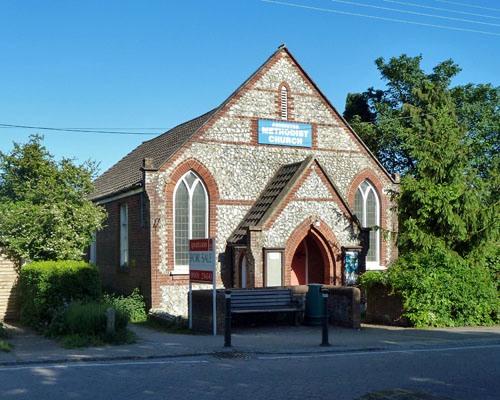
Ashington Methodist Church, Ashington, Methodist
hide
Hide
© Copyright Robin Webster and licensed for reuse under this Creative Commons Licence.
Hide
Ashington Methodist Church,
London Road,
Ashington
London Road,
Ashington
Hide
It was founded in 1891. It closed in 2010.
The present church replaced an iron building in 1894.
It was located at TQ1325616200 (Lat/Lon 50.934136, -0.389625). You can see this on maps provided by:
- OpenStreetMap
- Google Maps
- StreetMap (Current Ordnance Survey maps)
- Bing (was Multimap)
- Old Maps Online
- National Library of Scotland (Old Ordnance Survey maps)
- Vision of Britain (Click "Historical units & statistics" for administrative areas.)
- English Jurisdictions in 1851 (Unfortunately the LDS have removed the facility to enable us to specify a starting location, you will need to search yourself on their map.)
- Magic (Geographic information) (Click + on map if it doesn't show)
- GeoHack (Links to on-line maps and location specific services.)