
Hide
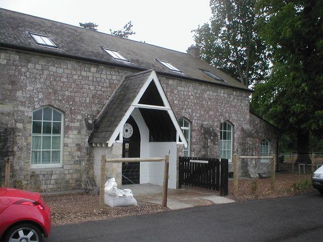
Funtington Congregational Chapel, Funtington, Congregational
hide
Hide
© Copyright Dr Paul Strickland and licensed for reuse under this Creative Commons Licence.
Hide
Funtington Congregational Chapel,
Common Road,
Funtington
Common Road,
Funtington
Hide
It was founded in 1864. It is now closed, but we do not know the date of closure .
In 1972 the Congregational church joined with the English Presbyterian church to become the United Reformed Church. Some Congregational churches though did not take this path and became members of the Congregational Federation.
It was located at SU8138208028 (Lat/Lon 50.866037, -0.844921). You can see this on maps provided by:
- OpenStreetMap
- Google Maps
- StreetMap (Current Ordnance Survey maps)
- Bing (was Multimap)
- Old Maps Online
- National Library of Scotland (Old Ordnance Survey maps)
- Vision of Britain (Click "Historical units & statistics" for administrative areas.)
- English Jurisdictions in 1851 (Unfortunately the LDS have removed the facility to enable us to specify a starting location, you will need to search yourself on their map.)
- Magic (Geographic information) (Click + on map if it doesn't show)
- GeoHack (Links to on-line maps and location specific services.)