
Hide
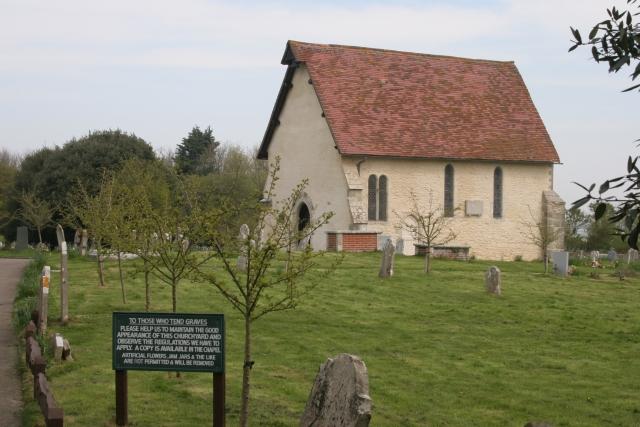
The Parish Church of St Wilfrid's Chapel, Church Norton, Selsey, Church of England
hide
Hide
© Copyright Brendan and Ruth McCartney and licensed for reuse under this Creative Commons Licence.
Hide
The Parish Church of St Wilfrid's Chapel,
Rectory Lane,
Church Norton, Selsey
Rectory Lane,
Church Norton, Selsey
Hide
It was founded in 13th C. It closed in 1865.
This is the surviving chancel of the original parish church. The remainder of the building was demolished in 1875.
It was located at SZ8719795753 (Lat/Lon 50.754839, -0.765221). You can see this on maps provided by:
- OpenStreetMap
- Google Maps
- StreetMap (Current Ordnance Survey maps)
- Bing (was Multimap)
- Old Maps Online
- National Library of Scotland (Old Ordnance Survey maps)
- Vision of Britain (Click "Historical units & statistics" for administrative areas.)
- English Jurisdictions in 1851 (Unfortunately the LDS have removed the facility to enable us to specify a starting location, you will need to search yourself on their map.)
- Magic (Geographic information) (Click + on map if it doesn't show)
- GeoHack (Links to on-line maps and location specific services.)