
Hide
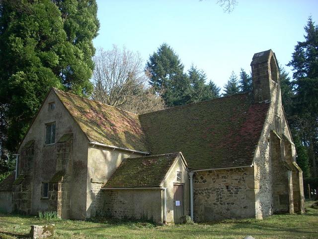
Tuxlith Chapel, Milland, Church of England
hide
Hide
Hide
Tuxlith Chapel,
London Portsmouth Road,
Milland
London Portsmouth Road,
Milland
Hide
It was founded in 16th C. It closed in 1878.
The original parish church of Milland, replaced by adjacent St Luke's.
Whilst every effort has been made to record exact details of record office and library holdings
you are recommended to check with them before visiting to ensure that they do hold the records and years you
wish to examine. Similarly check with transcript publishers to ensure they cover the records and years
you require before making a purchase.
Register Transcripts
Baptisms
- 1581-1721 WSRO
- 1581-1721 WSRO
- 1581-1721 WSRO
- 1581-1721 WSRO
- 1581-1879 WSRO
- 1581-1879 WSRO
Marriages
- 1581-1721 WSRO
- 1581-1721 WSRO
- 1581-1721 WSRO
- 1581-1721 WSRO
- 1581-1879 WSRO
- 1581-1879 WSRO
Burials
- 1581-1721 WSRO
- 1581-1721 WSRO
- 1581-1721 WSRO
- 1581-1721 WSRO
- 1581-1879 WSRO
- 1581-1879 WSRO
Indexes
Baptisms
- 1581-1875 FamilySearch/IGI batch C070851
- 1581-1875 FamilySearch/IGI batch C070851
Marriages
- 1592-1878 FamilySearch/IGI batch M070851
- 1592-1878 FamilySearch/IGI batch M070851
It was located at SU8254428257 (Lat/Lon 51.047744, -0.82383). You can see this on maps provided by:
- OpenStreetMap
- Google Maps
- StreetMap (Current Ordnance Survey maps)
- Bing (was Multimap)
- Old Maps Online
- National Library of Scotland (Old Ordnance Survey maps)
- Vision of Britain (Click "Historical units & statistics" for administrative areas.)
- English Jurisdictions in 1851 (Unfortunately the LDS have removed the facility to enable us to specify a starting location, you will need to search yourself on their map.)
- Magic (Geographic information) (Click + on map if it doesn't show)
- GeoHack (Links to on-line maps and location specific services.)