
Hide
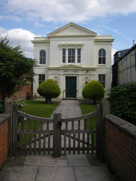
Church Street, Alcester, Baptist (General)
hide
Hide
Hide
Baptist (General) church,
Church Street,
Alcester
Warwickshire
Hide
The congregation was founded in around 1640, and was one of seven which formed the Midland Baptist Association in 1655. The congregation met in a private house until a new Meeting House was built on Meeting Lane in 1735. The present chapel was built in 1859, adjacent to the old chapel (now the church hall) and facing towards Church Street.
A more detailed history is available on the congregation's website.
The congregation holds a Membership Book for the year 1712.
Warwickshire Records Office hold a copy of the Minute Books 1712-1859.
It is located at SP0912557508 (Lat/Lon 52.215717, -1.867853). You can see this on maps provided by:
- OpenStreetMap
- Google Maps
- StreetMap (Current Ordnance Survey maps)
- Bing (was Multimap)
- Old Maps Online
- National Library of Scotland (Old Ordnance Survey maps)
- Vision of Britain (Click "Historical units & statistics" for administrative areas.)
- English Jurisdictions in 1851 (Unfortunately the LDS have removed the facility to enable us to specify a starting location, you will need to search yourself on their map.)
- Magic (Geographic information) (Click + on map if it doesn't show)
- GeoHack (Links to on-line maps and location specific services.)