
Hide
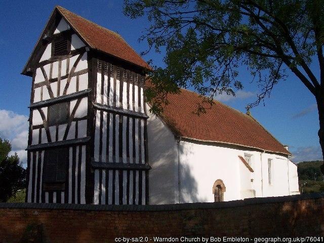
St Nicholas, Warndon, Church of England
hide
Hide
Hide
Hide
The Hive contains many records and the people there are always willing to look up items .http://www.thehiveworcester.org/research-collections.html
Originally a Norman church in the centre of a small parish, it is now surrounded by a new 4,000 house estate.
Primarily an Anglican church it is shared with the Methodist and United reformed church congregations.
It is located at SO8877856888 (Lat/Lon 52.210096, -2.165646). You can see this on maps provided by:
- OpenStreetMap
- Google Maps
- StreetMap (Current Ordnance Survey maps)
- Bing (was Multimap)
- Old Maps Online
- National Library of Scotland (Old Ordnance Survey maps)
- Vision of Britain (Click "Historical units & statistics" for administrative areas.)
- English Jurisdictions in 1851 (Unfortunately the LDS have removed the facility to enable us to specify a starting location, you will need to search yourself on their map.)
- Magic (Geographic information) (Click + on map if it doesn't show)
- GeoHack (Links to on-line maps and location specific services.)