
Hide
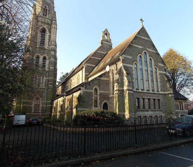
St Mary Magdalen, Worcester, Church of England
hide
Hide
Hide
Sansome Walk
Worcester
Hide
It was founded after 1876. Made redundant in 1977 and was converted to apartments in 1999 after years of neglect.
It was located somewhere in the place at SO848550 (Lat/Lon 52.192611, -2.223261). You can see this on maps provided by:
- OpenStreetMap
- Google Maps
- StreetMap (Current Ordnance Survey maps)
- Bing (was Multimap)
- Old Maps Online
- National Library of Scotland (Old Ordnance Survey maps)
- Vision of Britain (Click "Historical units & statistics" for administrative areas.)
- English Jurisdictions in 1851 (Unfortunately the LDS have removed the facility to enable us to specify a starting location, you will need to search yourself on their map.)
- Magic (Geographic information) (Click + on map if it doesn't show)
- GeoHack (Links to on-line maps and location specific services.)