
Hide
St Michael in Bedwardine, Worcester, Church of England
hide
Hide
Hide
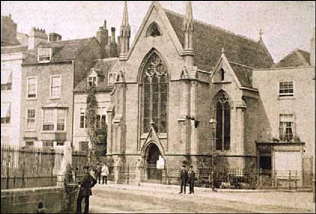
St. Michael in Bedwardine
Originally in Cathedral Close
Worcester
Hide
The medieval church dating from the Anglo saxon era was parish church and cemetery chapel for the cathedral close. This church was demolished in 1843 and replaced by another church on the other side of College Street which in turn was demolished in 1965.
It was located near SO850545 (Lat/Lon 52.188501, -2.22085). You can see this on maps provided by:
- OpenStreetMap
- Google Maps
- StreetMap (Current Ordnance Survey maps)
- Bing (was Multimap)
- Old Maps Online
- National Library of Scotland (Old Ordnance Survey maps)
- Vision of Britain (Click "Historical units & statistics" for administrative areas.)
- English Jurisdictions in 1851 (Unfortunately the LDS have removed the facility to enable us to specify a starting location, you will need to search yourself on their map.)
- Magic (Geographic information) (Click + on map if it doesn't show)
- GeoHack (Links to on-line maps and location specific services.)