
Hide
Acaster Malbis
hide
Hide
hide
Hide
Hide
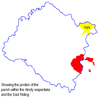
The Ancient Parish of ACASTER MALBIS
[Transcribed information mainly from the early 1820s]
"ACASTER MALBIS, a parish, situated on the Ouse; 4 miles S. of York. Here is a good School House, endowed with the products of some lands, under the patronage of certain trustees, who have the appointment of fourteen poor children, as proper objects to receive instruction free of cost. Mr. George Cowper, is the master, and Messrs. William Cundell, John Kettlewell, and John Oates, feoffees. The church is an ancient structure (see Churches for photograph), of which the Rev. Thomas Barker, is perpetual curate. The town derives its name from the family of the Malby's, which flourished here for some centuries after the conquest. Population, 291.""NABURN, in the parishes of Acaster Malbis and York St Dennis, (both in the Ainsty), wapentake of Ouse and Derwent, East Riding; 4 miles S. of York. Here is a Chapel of Ease of the Established church, and likewise a Methodist chapel. The town is situate near to the bank of the river Ouse. There is here also an endowed school of £10. per annum, for ten boys; £5. of which was left by Lady Hewley, and £5. by Mr. Edward Loftus. Population, 366."
[Description(s) edited mainly from various 19th century sources by Colin Hinson. ©2010]
Hide
- Here are photographs of Churches in the parish:
- Holy Trinity Church, Acaster Malbis. (With short history). (The Church's website is here.)
- Holy Trinity Church, Acaster Malbis ( from the other side.)
- The Methodist Church, Acaster Malbis. (With short history). (The Church's website is here.)
- St. Matthews Church, Naburn. (With short history). (The Church's website is here.)
- Transcript of the entry for Acaster Malbis in the "Collections relative to Churches and Chapels".
- The whereabouts and dates of the Registers etc. for the Parish of Acaster Malbis.
- A transcription of the Naburn Marriages 1800 to 1860 by Carol Ryan
- A transcription of the Naburn Burials 1778-1860 by Carol Ryan.
- Transcript of the entry of "professions and trades" in the Baines's Directory of 1823, of the North Riding.
- Transcript of the entry of "professions and trades" in the Bulmers Directory of 1890. of the North Riding.
- There is further information about this parish from the National Gazetteer 1868, Yorkshire extracts.
- There is further information about this parish from the Lewis's Topographical Dictionary of England 1835,, Yorkshire extracts.
- There is further information about this parish from the Bulmer's 1890 History and Directory of the North Riding.
- Ask for a calculation of the distance from Acaster Malbis to another place.
- For a detailed map of this parish see this parish boundaries map.
- For a more detailed map of the parishes in the riding please see the Yorkshire parish maps page.
- For a detailed map of the county please see the Yorkshire map page.
- Here is a map showing the wapentakes for the county.
You can see maps centred on OS grid reference SE587453 (Lat/Lon: 53.900552, -1.108123), Acaster Malbis which are provided by:
- OpenStreetMap
- Google Maps
- StreetMap (Current Ordnance Survey maps)
- Bing (was Multimap)
- Old Maps Online
- National Library of Scotland (Old Ordnance Survey maps)
- Vision of Britain (Click "Historical units & statistics" for administrative areas.)
- English Jurisdictions in 1851 (Unfortunately the LDS have removed the facility to enable us to specify a starting location, you will need to search yourself on their map.)
- Magic (Geographic information) (Click + on map if it doesn't show)
- GeoHack (Links to on-line maps and location specific services.)
- All places within the same township/parish shown on an Openstreetmap map.
- Nearby townships/parishes shown on an Openstreetmap map.
- Nearby places shown on an Openstreetmap map.
- The 1914-1918 War Memorial in Naburn Churchyard.
- This parish is covered by the following Society:
- A list of those paying the 1379 Subsidy Rolls (Poll Tax) for this parish.