
Hide
Drypool
hide
Hide
hide
Hide
Hide
The Ancient Parish of DRYPOOL
[Transcribed information mainly from the early 1820s]
"DRYPOOL, a parish in the wapentake and liberty of Holderness; on the eastern bank or the river Hull, and is considered a part or Kingston upon Hull. Its population amounts to 1409. Near to this place is supposed to have stood the village of Frismeck, swallowed up by the inundations of the Humber. The church is now rebuilding; the windows and arches of the old structure are carefully preserved, and the new ones worked from the same patterns and mouldings, so as to perpetuate the style of the old church, which is about the year 1300. The patron of this parochial curacy is William Wilberforce, Esq. and the church is dedicated to St Peter.""SOUTHCOATES, in the parish of Drypool, wapentake and liberty of Holderness; ¾ mile NE. of Drypool, 2 miles NE. of Hull. Pop. 798."
[Description(s) edited mainly from various 19th century sources by Colin Hinson. ©2010]
Hide
- Here are photographs of Churches etc. in the parish:
- The Church of St. John the Evangelist, Drypool. (The Church's website is here.)
- St. Aidan's Church, Drypool. (The Church's website is here.)
- The Roman Catholic Sacred Heart Church, Drypool. (The Church's website is here.)
- East Park Baptist Church, Summergangs.
- St Columba's Church, Summergangs. (The Church's website is here.)
- Holderness Road Methodist Church, Hull. (The Church's website is here.)
- Portobello Methodist Church, Hull.
- The Church of Jesus Christ of Latter Day Saints, Sutton Ings. This church was built in 1963 by the congregation.
- Holderness Road URC Church, Hull.
- The ex Presbyterian Sunday Schoool, Hull, now the Green Man Pub. This was next to the Presbyterian Church (which was demolished in 1972).
- The former Southcoates Lane Methodist Church, Drypool, now demolished.
- Kingdom Hall of Jehovah's Witnesses, Hull.
- Transcript of the entry for Drypool in the "Collections relative to Churches and Chapels".
- The whereabouts and dates of the Registers etc. for the Parish of Drypool.
- Transcript of the entry of "professions and trades" in the Baines's Directory of 1823, of the East Riding.
- There is further information about this parish from the National Gazetteer 1868, Yorkshire extracts.
- There is further information about this parish from the Lewis's Topographical Dictionary of England 1835, Yorkshire extracts.
- Ask for a calculation of the distance from Drypool to another place.
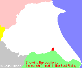
- For a detailed map of this parish see this parish boundaries map.
- For a more detailed map of the parishes in the riding please see the Yorkshire parish maps page.
- For a more detailed map of the county please see the Yorkshire map page.
- Here is a map showing the wapentakes for the county.
You can see maps centred on OS grid reference TA115295 (Lat/Lon: 53.749951, -0.310569), Drypool which are provided by:
- OpenStreetMap
- Google Maps
- StreetMap (Current Ordnance Survey maps)
- Bing (was Multimap)
- Old Maps Online
- National Library of Scotland (Old Ordnance Survey maps)
- Vision of Britain (Click "Historical units & statistics" for administrative areas.)
- English Jurisdictions in 1851 (Unfortunately the LDS have removed the facility to enable us to specify a starting location, you will need to search yourself on their map.)
- Magic (Geographic information) (Click + on map if it doesn't show)
- GeoHack (Links to on-line maps and location specific services.)
- All places within the same township/parish shown on an Openstreetmap map.
- Nearby townships/parishes shown on an Openstreetmap map.
- Nearby places shown on an Openstreetmap map.
- The following places are within the boundaries of this (ancient) parish, but I have no further information on them other than the Ordnance Survey Landranger Grid reference shown:
- (TA113308) Summergangs
- This parish is covered by the following Society:
- The 1834 Electoral Roll for this parish