Hide
Flamborough
hide
Hide
hide
Hide
hide
Hide
Hide
The Ancient Parish of FLAMBOROUGH
[Transcribed information mainly from the early 1820s]
"FLAMBOROUGH, a parish in the wapentake of Dickering; 4½ miles NE. of Bridlington, and 21 SE. of Scarborough. A very ancient station, formerly of some note, but at present merely a fishing village, situated in the centre of the promontory. The population of Flamborough amounts to 917, of which number, the fishermen and their families constitute at least one half. In addition to the church of St. Oswald mentioned above (see Churches for photograph), there are here a Methodist chapel, and a chapel for the Primitive Methodists." (There is further information for Flamborough). [Description(s) edited mainly from various 19th century sources by Colin Hinson. ©2010]
Hide
- Photographs of over 1,000 gravestones and plaques at Flamborough with linked surname index.
- Martin Cross has transcribed the 1901 Census "strays" for Flamborough. There are over 200 names in his list.
- Here are photographs of Churches etc. in the parish:
- St. Oswald's Church, Flamborough.
- Internal view looking down the nave
- The font
- The Methodist Church, Flamborough. (The Church's website is here.)
- St. Oswald's Church, Flamborough.
- Transcript of the entry for Flamborough in the "Collections relative to Churches and Chapels".
- The whereabouts and dates of the Registers etc. for the Parish of Flamborough.
- The List of Vicars at Flamborough in St. Oswald's Church.
- Here are photographs of the Flamborough area:
- North Landing, Flamborough Head (view 1).
- North Landing, Flamborough Head (view 2).
- The (new) Lighthouse, Flamborough.
- The Foghorn Station, Flamborough.
- Selwick Bay, Flamborough.
- A Flamborough Crab Fisherman at North Landing in the 1940s.
- Transcript of the entry of "professions and trades" in the Baines's Directory of 1823, of the East Riding.
- Transcript of the entry of "professions and trades" in the Bulmers Directory of 1892. of the East Riding.
- There is further information about this parish from the Pigot's 1834 Directory, Yorkshire section.
- There is further information about this parish from the National Gazetteer 1868, Yorkshire extracts.
- There is further information about this parish from the Lewis's Topographical Dictionary of England 1835, Yorkshire extracts.
- There is further information about this parish from the Stephen Whatley's Gazetteer 1750, Yorkshire extracts.
- There is further information about this parish from the Bulmer's 1892 History and Directory of the East Riding.
- Ask for a calculation of the distance from Flamborough to another place.

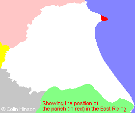
- For a detailed map of this parish see this parish boundaries map.
- For a more detailed map of the parishes in the riding please see the Yorkshire parish maps page.
- For a more detailed map of the county please see the Yorkshire map page.
- Here is a map showing the wapentakes for the county.
You can see maps centred on OS grid reference TA226702 (Lat/Lon: 54.113069, -0.126019), Flamborough which are provided by:
- OpenStreetMap
- Google Maps
- StreetMap (Current Ordnance Survey maps)
- Bing (was Multimap)
- Old Maps Online
- National Library of Scotland (Old Ordnance Survey maps)
- Vision of Britain (Click "Historical units & statistics" for administrative areas.)
- English Jurisdictions in 1851 (Unfortunately the LDS have removed the facility to enable us to specify a starting location, you will need to search yourself on their map.)
- Magic (Geographic information) (Click + on map if it doesn't show)
- GeoHack (Links to on-line maps and location specific services.)
- All places within the same township/parish shown on an Openstreetmap map.
- Nearby townships/parishes shown on an Openstreetmap map.
- Nearby places shown on an Openstreetmap map.
- The Flamborough book of Service, 1939-1945 in St. Oswald's, Flamborough.
- The Flamborough book of Service, Introduction.
- The Flamborough book of Service, The R.A.F.
- The Flamborough book of Service, RN Auxiliary and the WRNS.
- The Flamborough book of Service, The Army and A.T.S.
- The Flamborough book of Service, Addenda.
- The Flamborough book of Service, Fire Guards.
- The Flamborough book of Service, Coastguards.
- The Flamborough book of Service, Royal Observer Corps.
- The Flamborough book of Service, R.N.L.I.
- The Flamborough book of Service, Civil Defence.
- The Flamborough book of Service, The St John Ambulance Brigade.
- The Flamborough book of Service, National Fire Service.
- The Memorial Flamborough village for the men who died in two cobles off Flamborough Head 1909.
- The Memorial in Flamborough village for the men who on the Carol Sandra and the North Wind III in 1984.
- The World War I and II Memorial in front of the castle at Flamborough.
- Photgraphs of over 1,000 gravestones and plaques at Flamborough.
- The following places are within the boundaries of this (ancient) parish, but I have no further information on them other than the Ordnance Survey Landranger Grid reference shown:
- (TA231693) South Landing
- (TA223710) The Grange (was Grange Farm)
- Pam Smith has supplied an article on "The Climmers" or Egg Gatherers of the cliffs of Filey, Speeton, Bempton and Flamborough.
- This parish is covered by the following Society:
- The 1834 Electoral Roll for this parish

