
Hide
Folkton
hide
Hide
hide
Hide
Hide
The Ancient Parish of FOLKTON
[Transcribed information mainly from the early 1820s]
"FOLKTON, a parish in the wapentake of Dickering; 3 miles N.W. of Hunmanby. This is a rectory and vicarage, in the patronage of the Osbaldeston family and of the rector of Folkton, of which the Rev. Robert Phillips is the rector, and the Rev. F. Wrangham the vicar. The church is dedicated to St. John the Evangelist (see Churches for photograph). Pop. 144.""EAST FLOTMANBY, in the parish of Folkton and wapentake of Dickering; 1¾ miles E. of Folkton, 1½ mile N.W. of Hunmanby."
"FLIXTON, in the parish of Folkton and wapentake of Dickering; 1½ miles W. of Folkton, 4 miles N.W. of Hunmanby. There is here a chapel occupied by the Primitive Methodists. Population, 267.
In the reign of Athelstan, Achorne, Lord of Flixton, built an hospital for 1 alderman and 14 brothers and sisters, at Flixton, for the preservation of people travelling that way, that they might not be devoured by wolves and other wild beasts, then abounding there, &c. --Dugdale. A certain portion of land in this vicinity is still distinguished by the name of Wolfland, and on the spot where the hospital stood, is now a farm house called Spital."
"WEST FLOTMANBY, in the parish of Folkton and wapentake of Dickering; 1¼ miles E. of Folkton, 2½ miles N.W. of Hunmanby."
[Description(s) edited mainly from various 19th century sources by Colin Hinson. ©2010]
Hide
- Photographs of over 170 gravestones in Folkton Graveyard with linked surname index..
- Photographs of over 140 gravestones in Flixton Cemetery with linked surname index..
- Here are photographs of Churches etc. in the parish:
- St John The Evangelist's Church, Folkton, view 1.
- St John The Evangelist's Church, Folkton, view 2
- Internal view looking down the nave
- The East Window
- The font
- Transcript of the entry for Folkton in the "Collections relative to Churches and Chapels".
- The whereabouts and dates of the Registers etc. for the Parish of Folkton.
- The List of the Rectors and Vicars in St. John's church, Folkton.
- Transcript of the entry of "professions and trades" in the Baines's Directory of 1823, of the East Riding.
- Transcript of the entry of "professions and trades" in the Bulmers Directory of 1892. of the East Riding.
- Transcript of the entry of "professions and trades" in the The Scarborough Gazette of 1905,
- There is further information about this parish from the National Gazetteer 1868, Yorkshire extracts.
- There is further information about this parish from the Lewis's Topographical Dictionary of England 1835, Yorkshire extracts.
- There is further information about this parish from the Stephen Whatley's Gazetteer 1750, Yorkshire extracts.
- There is further information about this parish from the Bulmer's 1892 History and Directory of the East Riding.
- Ask for a calculation of the distance from Folkton to another place.
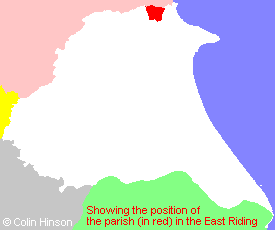
- For a detailed map of this parish see this parish boundaries map.
- For a more detailed map of the parishes in the riding please see the Yorkshire parish maps page.
- For a more detailed map of the county please see the Yorkshire map page.
- Here is a map showing the wapentakes for the county.
You can see maps centred on OS grid reference TA053797 (Lat/Lon: 54.202244, -0.387226), Folkton which are provided by:
- OpenStreetMap
- Google Maps
- StreetMap (Current Ordnance Survey maps)
- Bing (was Multimap)
- Old Maps Online
- National Library of Scotland (Old Ordnance Survey maps)
- Vision of Britain (Click "Historical units & statistics" for administrative areas.)
- English Jurisdictions in 1851 (Unfortunately the LDS have removed the facility to enable us to specify a starting location, you will need to search yourself on their map.)
- Magic (Geographic information) (Click + on map if it doesn't show)
- GeoHack (Links to on-line maps and location specific services.)
- All places within the same township/parish shown on an Openstreetmap map.
- Nearby townships/parishes shown on an Openstreetmap map.
- Nearby places shown on an Openstreetmap map.
- The Memorial plaque in St. John's Church, Folkton.
- The 1914-18 and 1939-45 War Memorial for Folkton and Flixton, opposite Flixton Cemetery..
- The following places are within the boundaries of this (ancient) parish, but I have no further information on them other than the Ordnance Survey Landranger Grid reference shown:
- (TA053767) Danebury Manor
- (TA050795) Folkton House
- (TA059796) Folkton Manor
- This parish is covered by the following Society:
- The 1834 Electoral Roll for this parish