
Hide
Great Givendale
hide
Hide
hide
Hide
Hide
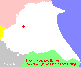
The Ancient Parish of GREAT GIVENDALE
[Transcribed information mainly from the early 1820s]
"GREAT GIVENDALE, a parish in the wapentake of Harthill, and liberty of St. Peter's; 4 miles N. of Pocklington. The church is a small ancient structure (see Churches for photograph), of which the Dean of York is the patron, and the Rev. Edmund Holmes the vicar. Pop. 60.""GRIMTHORPE, in the parish of Great Givendale, wapentake of Harthill, and liberty of St. Peter's; ½ mile SSE. of Great Givendale, 4 miles N. of Pocklington. Pop. 29."
"LITTLE GIVENDALE, 2 farm houses in the parish of Great Givendale, wapentake of Harthill, and liberty of St. Peter's; 1 mile ESE. of Great Givendale, 2½ miles NNE. of Pocklington"
[Description(s) edited mainly from various 19th century sources by Colin Hinson. ©2010]
Hide
- Photographs of the over 35 gravestones in Great Givendale Churchyard with a surname index.
- Here are photographs of St. Ethelburga's Church, Great Givendale.
- View 1. (The Church's website is here.)
- Internal view looking down the aisle
- The font and font cover
- View 2.
- View 1. (The Church's website is here.)
- Transcript of the entry for Great Givendale in the "Collections relative to Churches and Chapels".
- The whereabouts and dates of the Registers etc. for the Parish of Great Givendale.
- The List of Incumbents in Great Givendale church.
- Transcript of the entry of "professions and trades" in the Baines's Directory of 1823, of the East Riding.
- Transcript of the entry of "professions and trades" in the The Post Office Directory of the, East and North Ridings, 1857
- Transcript of the entry of "professions and trades" in the Bulmers Directory of 1892. of the East Riding.
- There is further information about this parish from the National Gazetteer 1868, Yorkshire extracts.
- There is further information about this parish from the Lewis's Topographical Dictionary of England 1835, Yorkshire extracts.
- There is further information about this parish from the Bulmer's 1892 History and Directory of the East Riding.
- Ask for a calculation of the distance from Great Givendale to another place.
- For a detailed map of this parish see this parish boundaries map.
- For a more detailed map of the parishes in the riding please see the Yorkshire parish maps page.
- For a more detailed map of the county please see the Yorkshire map page.
- Here is a map showing the wapentakes for the county.
You can see maps centred on OS grid reference SE811538 (Lat/Lon: 53.973915, -0.765037), Great Givendale which are provided by:
- OpenStreetMap
- Google Maps
- StreetMap (Current Ordnance Survey maps)
- Bing (was Multimap)
- Old Maps Online
- National Library of Scotland (Old Ordnance Survey maps)
- Vision of Britain (Click "Historical units & statistics" for administrative areas.)
- English Jurisdictions in 1851 (Unfortunately the LDS have removed the facility to enable us to specify a starting location, you will need to search yourself on their map.)
- Magic (Geographic information) (Click + on map if it doesn't show)
- GeoHack (Links to on-line maps and location specific services.)
- All places within the same township/parish shown on an Openstreetmap map.
- Nearby townships/parishes shown on an Openstreetmap map.
- Nearby places shown on an Openstreetmap map.
- This parish is covered (or partly covered) by the following Societies:
- The 1834 Electoral Roll for this parish