
Hide
Nafferton
hide
Hide
hide
Hide
Hide
The Ancient Parish of NAFFERTON
[Transcribed information mainly from the early 1820s]
"NAFFERTON, a parish in the wapentake of Dickering; 2 miles NE. of Driffield. The church is dedicated to All-Saints (see Churches for photograph), and the living is a vicarage, of which the Rev. John Ewbank, is the incumbent, and the Archbishop of York the patron. Here are chapels for the Methodists and Independents. Pop. 917.This church was an ancient rectory, belonging to the patronage of the Percys, till Sir Henry Percy, Knight, gave it to the Abbot and Convent of Meaux, about 1304; a vicarage was then ordained for a perpetual vicar to serve the church; to have cure of souls, &c. Thomas, Archbishop of York, decreed that this vicarage should consist of 20 marks sterling, payable quarterly, by the said religious. This sum the vicar enjoys to this day, and which is paid by the lay impropriator.
In 1709, a Mr. John Baron, of Bridlington, left the sum of 5L. annually to the school here."
"POCKTHORPE, in the parish of Nafferton, and wapentake of Dickering; (Pockthorpe-House, the seat of William Hall, Esq.) 4 miles NNE. of Driffield."
"WANSFORD, in the parish of Nafferton and wapentake of Dickering; 1¾ miles SSE. of Nafferton, 3 miles E. of Driffield. Here is a considerable cotton and carpet manufactory, the only establishment of the kind in this part of the country, standing on the navigable river Hull. Population, 314."
[Description(s) edited mainly from various 19th century sources by Colin Hinson. ©2010]
Hide
- Photographs of over 820 gravestones etc at Nafferton Church with linked surname index.
- Photographs of over 110 gravestones and plaques at Wansford church with linked surname index.
- Here are photographs of Churches in the parish:
- All Saints' Church, Nafferton.
- Internal view looking down the nave
- The font
- The Methodist Church, Nafferton.
- St. Mary's Church, Wansford.
- Internal view looking down the nave
- The East Window
- The font
- All Saints' Church, Nafferton.
- Transcript of the entry for Nafferton in the "Collections relative to Churches and Chapels".
- The whereabouts and dates of the Registers etc. for the Parish of Nafferton.
- Transcript of the entry of "professions and trades" in the Baines's Directory of 1823, of the East Riding.
- Transcript of the entry of "professions and trades" in the Bulmers Directory of 1892. of the East Riding.
- There is further information about this parish from the Pigot's 1829 Directory, Yorkshire section.
- There is further information about this parish from the Pigot's 1834 Directory, Yorkshire section.
- There is further information about this parish from the National Gazetteer 1868, Yorkshire extracts.
- There is further information about this parish from the Lewis's Topographical Dictionary of England 1835, Yorkshire extracts.
- There is further information about this parish from the Bulmer's 1892 History and Directory of the East Riding.
- Ask for a calculation of the distance from Nafferton to another place.
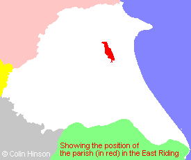
- For a detailed map of this parish see this parish boundaries map.
- For a more detailed map of the parishes in the riding please see the Yorkshire parish maps page.
- For a more detailed map of the county please see the Yorkshire map page.
- Here is a map showing the wapentakes for the county.
You can see maps centred on OS grid reference TA055590 (Lat/Lon: 54.016236, -0.391377), Nafferton which are provided by:
- OpenStreetMap
- Google Maps
- StreetMap (Current Ordnance Survey maps)
- Bing (was Multimap)
- Old Maps Online
- National Library of Scotland (Old Ordnance Survey maps)
- Vision of Britain (Click "Historical units & statistics" for administrative areas.)
- English Jurisdictions in 1851 (Unfortunately the LDS have removed the facility to enable us to specify a starting location, you will need to search yourself on their map.)
- Magic (Geographic information) (Click + on map if it doesn't show)
- GeoHack (Links to on-line maps and location specific services.)
- All places within the same township/parish shown on an Openstreetmap map.
- Nearby townships/parishes shown on an Openstreetmap map.
- Nearby places shown on an Openstreetmap map.
- The World War I Memorial Plaque in All Saint's Church.
- The WWI Roll of Honour in Wansford church.
- The WWI and WWII memorial plaque in Wansford church.
- The following places are within the boundaries of this (ancient) parish, but I have no further information on them other than the Ordnance Survey Landranger Grid reference shown:
- (TA048609) Nafferton Grange
- (TA050624) Nafferton Kesters
- (TA053610) Wold House
- This parish is covered by the following Society:
- The 1834 Electoral Roll for this parish