
Hide
Roos
hide
Hide
hide
Hide
Hide
The Ancient Parish of ROOS
[Transcribed information mainly from the early 1820s]
"ROOS, a parish in the wapentake and liberty of Holderness; 8 miles E. of Hedon. The church, dedicated to All Saints, is a fine specimen of Gothic architecture (see Churches for photograph), and the patron and rector is the Rev. Christopher Sykes. The family vault of the Sykes's of Sledmere, is in this church. Population, 442.""BRACKEN HILL, a farm house in the township of Garton, and parishes of Garton and Roos; 2¾ miles N. of Roos, 9 miles from Hedon."
"GRIMSTON, in the parishes of Garton and Roos, middle-division of Holderness; (Grimston-Garth, the seat of Charles Grimston, Esq.) 10 miles from Hedon, 14 from Hull, 21 from Beverley.
This mansion is a superb structure, of a castellated form, and although of modern erection, displays in its architecture much of the ancient style of baronial magnificence; being one of the most elevated situations in Holderness, it is both a very conspicuous object, and commands a variety of extensive and magnificent prospects. --Bigland.
The family of Grimstons is one of the few in the county, that reside on the estate from which they are denominated. This family is descended from Sylvester de Grimston, of Grimston, who attended William, Duke of Normandy, in his expedition to England as his standard bearer, and in that station, valiantly fought at the battle of Hastings; and in the year following, on the conqueror settling his household, he was appointed his chamberlain, and did homage for Grimston, Hoxton, Tonsted, and other lands, which he held of the Lord Roos, in Holderness, as of his honour of Roos; he was succeeded at Grimston by his son Daniel. The present Grimstons are descendants. --Collins' Peerage."
"OWSTWICK, in the parishes of Garton and Roos, wapentake and liberty of Holderness, 8 miles ENE. of Hedon. Population 139."
[Description(s) edited mainly from various 19th century sources by Colin Hinson. ©2010]
Hide
- Photographs of the over 520 gravestones in Roos Churchyard with linked surname index.
- Here are photographs of Churches etc. in the parish:
- All Saints' Church, Roos - view 1.
- All Saints' Church, Roos - view 2.
- Transcript of the entry for Roos in the "Collections relative to Churches and Chapels".
- The whereabouts and dates of the Registers etc. for the Parish of Roos.
- Transcript of the entry of "professions and trades" in the Baines's Directory of 1823, of the East Riding.
- Transcript of the entry of "professions and trades" in the Bulmers Directory of 1892. of the East Riding.
- There is further information about this parish from the National Gazetteer 1868, Yorkshire extracts.
- There is further information about this parish from the Lewis's Topographical Dictionary of England 1835, Yorkshire extracts.
- There is further information about this parish from the Stephen Whatley's Gazetteer 1750, Yorkshire extracts.
- There is further information about this parish from the Bulmer's 1892 History and Directory of the East Riding.
- Ask for a calculation of the distance from Roos to another place.
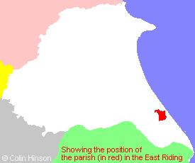
- For a detailed map of this parish see this parish boundaries map.
- For a more detailed map of the parishes in the riding please see the Yorkshire parish maps page.
- For a more detailed map of the county please see the Yorkshire map page.
- Here is a map showing the wapentakes for the county.
You can see maps centred on OS grid reference TA291305 (Lat/Lon: 53.754877, -0.043405), Roos which are provided by:
- OpenStreetMap
- Google Maps
- StreetMap (Current Ordnance Survey maps)
- Bing (was Multimap)
- Old Maps Online
- National Library of Scotland (Old Ordnance Survey maps)
- Vision of Britain (Click "Historical units & statistics" for administrative areas.)
- English Jurisdictions in 1851 (Unfortunately the LDS have removed the facility to enable us to specify a starting location, you will need to search yourself on their map.)
- Magic (Geographic information) (Click + on map if it doesn't show)
- GeoHack (Links to on-line maps and location specific services.)
- All places within the same township/parish shown on an Openstreetmap map.
- Nearby townships/parishes shown on an Openstreetmap map.
- Nearby places shown on an Openstreetmap map.
- This parish is covered by the following Society:
- The 1834 Electoral Roll for this parish