
Hide
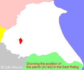
Seaton Ross
hide
Hide
hide
Hide
Hide
The Ancient Parish of SEATON ROSS
[Transcribed information mainly from the early 1820s]
"SEATON ROSS, a parish in the wapentake of Harthill; 6 miles SSW. of Pocklington. The church, dedicated to St. Edmund, is a neat modern structure (see Churches for photograph), of which the Rev. Thomas Brown is vicar, and the University of Cambridge the patron. Here is also a Methodist chapel. A smart shock of an earthquake was felt at this and several of the neighbouring villages, on the 18th of January, 1822. Pop 477.""LINCOLN FLATTS, a single house in the parish of Seaton Ross, and wapentake of Harthill; 2¼ miles S. of Seaton Ross, 7 miles from Market Weighton."
"RYTHAM GATE, 2 houses in the parish of Seaton Ross, and wapentake of Harthill; ¾ mile NNE. of Seaton Ross, 5 miles S. of Pocklington."
"SEATON HALL, (New), a single house in the township and parish of Seaton-Ross; 1½ miles SSE. of Seaton Ross, 6½ miles from Pocklington."
"SEATON OLD HALL, a single house in the township and parish of Seaton-Ross; 1¼ miles S. of Seaton Ross, 6½ miles from Pocklington, 7 from Market-Weighton."
[Description(s) edited mainly from various 19th century sources by Colin Hinson. ©2010]
Hide
- Photographs of the over 330 gravestones in Seaton Ross Churchyard with a linked surname index.
- Here are photographs of Churches etc. in the parish:
- St. Edmund's Church, Seaton Ross.
- The former Primitive Methodist Chapel of unknown denomination, Seaton Ross.
- Transcript of the entry for Seaton Ross in the "Collections relative to Churches and Chapels".
- The whereabouts and dates of the Registers etc. for the Parish of Seaton Ross.
- Transcript of the entry of "professions and trades" in the Baines's Directory of 1823, of the East Riding.
- Transcript of the entry of "professions and trades" in the The Post Office Directory of the, East and North Ridings, 1857
- Transcript of the entry of "professions and trades" in the Bulmers Directory of 1892. of the East Riding.
- There is further information about this parish from the National Gazetteer 1868, Yorkshire extracts.
- There is further information about this parish from the Lewis's Topographical Dictionary of England 1835, Yorkshire extracts.
- There is further information about this parish from the Bulmer's 1892 History and Directory of the East Riding.
- Ask for a calculation of the distance from Seaton Ross to another place.
- For a detailed map of this parish see this parish boundaries map.
- For a more detailed map of the parishes in the riding please see the Yorkshire parish maps page.
- For a more detailed map of the county please see the Yorkshire map page.
- Here is a map showing the wapentakes for the county.
You can see maps centred on OS grid reference SE780415 (Lat/Lon: 53.863866, -0.81542), Seaton Ross which are provided by:
- OpenStreetMap
- Google Maps
- StreetMap (Current Ordnance Survey maps)
- Bing (was Multimap)
- Old Maps Online
- National Library of Scotland (Old Ordnance Survey maps)
- Vision of Britain (Click "Historical units & statistics" for administrative areas.)
- English Jurisdictions in 1851 (Unfortunately the LDS have removed the facility to enable us to specify a starting location, you will need to search yourself on their map.)
- Magic (Geographic information) (Click + on map if it doesn't show)
- GeoHack (Links to on-line maps and location specific services.)
- All places within the same township/parish shown on an Openstreetmap map.
- Nearby townships/parishes shown on an Openstreetmap map.
- Nearby places shown on an Openstreetmap map.
- This parish is covered (or partly covered) by the following Societies:
- The 1834 Electoral Roll for this parish