
Hide
Watton
hide
Hide
hide
Hide
Hide
The Ancient Parish of WATTON
[Transcribed information mainly from the early 1820s]
"WATTON, a parish in the wapentake of Harthill; 6 miles S. of Driffield, situated on the high road leading from that place to Beverley; it is called the ancient Vetadun, a place which, at an early period, was consecrated to religion. It appears from Bede's Ecclesiastical History, that here was a nunnery about A. D. 686, but by whom founded, or how demolished, does not appear. About the year 1150, Eustace Fitz John founded here a priory of Gilbertine nuns, of the Order of Sempringham, and thirteen canons; the number of nuns was fifty-three. Like all other religious houses, this monastery has suffered great dilapidations; but the worthy family of the Bethel's have preserved what remains of the buildings, since it came into their possession; and the venerable relics of this ancient structure still merit the attention of the antiquary. The church here (see Churches for photograph), like the ancient monastery, is dedicated to St. Mary; George Bethell, Esq. is the patron, and the Rev. George Ferreman the incumbent, Pop. 307.""BURNBUTTS, a farm house in the parish of Watton, and wapentake of Harthill; 1¾ miles NW. of Watton, 6 miles SSW. of Driffield."
"CAWKELD, a farm house in the parish of Watton, and wapentake of Harthill; 1¼ miles W. of Watton, 6½ miles SSW of Driffield."
"STANDING HOLME, (or Seven Hills or Stanningholme), in the parish of Watton, and wapentake of Harthill; 3¾ miles E. of Watton, 8 miles SSE. of Driffield."
"SWINEKELD, a farm house in the parish of Watton, and wapentake of Harthill; ¾ mile NE. of Watton, 5 miles from Driffield."
"TOPHILL LOW, a farmhouse in the parish of Watton, on the banks of the River Hull; 3¾ miles ESE. of Watton."
[Description(s) edited mainly from various 19th century sources by Colin Hinson. ©2010]
Hide
- Photographs of over 150 gravestones in Watton Churchyard with linked surname index.
- Here are photographs of Churches etc. in the parish:
- St. Mary's Church, Watton.
- Internal view looking down the aisle
- The East Window
- The font
- The former Primitive Methodist Chapel, Watton (opened in 1887).
- St. Mary's Church, Watton.
- Transcript of the entry for Watton in the "Collections relative to Churches and Chapels".
- The whereabouts and dates of the Registers etc. for the Parish of Watton.
- Transcript of the entry of "professions and trades" in the Baines's Directory of 1823, of the East Riding.
- Transcript of the entry of "professions and trades" in the The Post Office Directory of the, East and North Ridings, 1857
- Transcript of the entry of "professions and trades" in the Bulmers Directory of 1892. of the East Riding.
- There is further information about this parish from the National Gazetteer 1868, Yorkshire extracts.
- There is further information about this parish from the Lewis's Topographical Dictionary of England 1835, Yorkshire extracts.
- There is further information about this parish from the Bulmer's 1892 History and Directory of the East Riding.
- Ask for a calculation of the distance from Watton to another place.
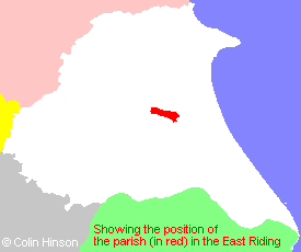
- For a detailed map of this parish see this parish boundaries map.
- For a more detailed map of the parishes in the riding please see the Yorkshire parish maps page.
- For a more detailed map of the county please see the Yorkshire map page.
- Here is a map showing the wapentakes for the county.
You can see maps centred on OS grid reference TA016502 (Lat/Lon: 53.937955, -0.453803), Watton which are provided by:
- OpenStreetMap
- Google Maps
- StreetMap (Current Ordnance Survey maps)
- Bing (was Multimap)
- Old Maps Online
- National Library of Scotland (Old Ordnance Survey maps)
- Vision of Britain (Click "Historical units & statistics" for administrative areas.)
- English Jurisdictions in 1851 (Unfortunately the LDS have removed the facility to enable us to specify a starting location, you will need to search yourself on their map.)
- Magic (Geographic information) (Click + on map if it doesn't show)
- GeoHack (Links to on-line maps and location specific services.)
- All places within the same township/parish shown on an Openstreetmap map.
- Nearby townships/parishes shown on an Openstreetmap map.
- Nearby places shown on an Openstreetmap map.
- This parish is covered by the following Society:
- The 1834 Electoral Roll for this parish