
Hide
Appleton Wiske
hide
Hide
hide
Hide
Hide
hide
Hide
The Ancient Parish of APPLETON WISKE
[Transcribed information mainly from the early 1820s]
"APPLETON WISKE, a parish in the wapentake and liberty of Langbargh; 7 miles SSW. of Yarm. Here is a small church (see Churches for photograph) the living is a perpetual curacy, of which the Rev. James Hewgill, rector of Great Smeaton, is the incumbent. Here is also a Methodist chapel. This village is in the district called Cleveland, and takes its name from the Wisk, a small rivulet which runs through the township. The linen manufacture is carried on here to a considerable extent. Pop. 492." [Description(s) edited mainly from various 19th century sources by Colin Hinson. ©2010]
Hide
- Here are photographs of Churches etc. in the parish:
- St. Mary's Church, Appleton Wiske (view 1). (With short history).
- St. Mary's Church, Appleton Wiske (view 2).
- Internal view looking from the Chancel towards the Sanctuary with its three lancet windows.
- Appleton Wiske Methodist Church, Appleton Wiske. (With short history). (The Church's website is here.)
- A transcript of Appleton Wiske Congregational Church History
- The whereabouts and dates of the Registers etc. for the Parish of Appleton Wiske.
- Transcript of the entry of "professions and trades" in the Baines's Directory of 1823, of the North Riding.
- There is further information about this parish from the National Gazetteer 1868, Yorkshire extracts.
- There is further information about this parish from the Lewis's Topographical Dictionary of England 1835, Yorkshire extracts.
- Ask for a calculation of the distance from Appleton Wiske to another place.
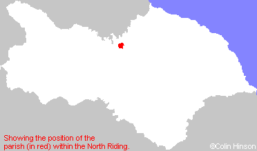
- For a detailed map of this parish see this parish boundaries map.
- For a more detailed map of the parishes in the riding please see the Yorkshire parish maps page.
- For a more detailed map of the county please see the Yorkshire map page.
- Here is a map showing the wapentakes for the county.
You can see maps centred on OS grid reference NZ391048 (Lat/Lon: 54.437118, -1.398694), Appleton Wiske which are provided by:
- OpenStreetMap
- Google Maps
- StreetMap (Current Ordnance Survey maps)
- Bing (was Multimap)
- Old Maps Online
- National Library of Scotland (Old Ordnance Survey maps)
- Vision of Britain (Click "Historical units & statistics" for administrative areas.)
- English Jurisdictions in 1851 (Unfortunately the LDS have removed the facility to enable us to specify a starting location, you will need to search yourself on their map.)
- Magic (Geographic information) (Click + on map if it doesn't show)
- GeoHack (Links to on-line maps and location specific services.)
- All places within the same township/parish shown on an Openstreetmap map.
- Nearby townships/parishes shown on an Openstreetmap map.
- Nearby places shown on an Openstreetmap map.
- This parish is covered by the following Society: