
Hide
Birkby
hide
Hide
hide
Hide
Hide
hide
Hide
The Ancient Parish of BIRKBY
[Transcribed information mainly from the early 1820s]
"BIRKBY, (or Bretby) a parish in the wapentake and liberty of Allertonshire; 6 miles N. of Northallerton. The church is dedicated to St. Peter; the living is a rectory, in the patronage of the Bishop of Durham. Population, 90.""HUTTON BONVILLE, in the parish of Birkby, wapentake and liberty of Allertonshire; 2 miles S. of Birkby, 5 miles NW. of Northallerton. The principal inhabitant is Henry Pierce, Esq. M. P. who resides at the hall. The Church, peculiar, is a perpetual curacy, dedicated to St. Laurence. Patron, Henry Peirse, Esq. Population, 107.
The mansion and estate of Hutton-Bonville, recently purchased by Henry Peirse, Esq. and adjoins his other estates at Lazenby, &c. all once the property and residence of the ancient family of Conyers. The last Baronet of that family (Sir Thomas) died a few years ago in Chester-le-Street."
"LITTLE SMEATON, in the parish of Birkby, wapentake and liberty of Allertonshire; 1¼ miles NE. of Birkby, 6 miles N. of Northallerton. Population, 64."
"LOVESOME HILL, a hamlet in the parish of Birkby, wapentake and liberty of Allertonshire; 2¾ miles SE. of Birkby, 3½ miles N. of Northallerton. Pop. included with Hutton Bonville."
[Description(s) edited mainly from various 19th century sources by Colin Hinson. ©2010]
Hide
- Here are photographs of Churches etc. in the parish:
- St. Peter's Church, Birkby. (With short history).
- St. Lawrence's Church, Hutton Bonville.
- Transcript of the entry for Birkby in the "Collections relative to Churches and Chapels".
- Transcript of the entry for Hutton Bonville in the "Collections relative to Churches and Chapels".
- The whereabouts and dates of the Registers etc. for the Parish of Birkby.
- The whereabouts and dates of the Registers etc. for the Township of Hutton Bonville.
- Transcript of the entry of "professions and trades" in the Baines's Directory of 1823, of the North Riding.
- Transcript of the entry of "professions and trades" in the Bulmers Directory of 1890. of the North Riding.
- There is further information about this parish from the National Gazetteer 1868, Yorkshire extracts.
- There is further information about this parish from the Lewis's Topographical Dictionary of England 1835, Yorkshire extracts.
- There is further information about this parish from the Bulmer's 1890 History and Directory of the North Riding.
- Ask for a calculation of the distance from Birkby to another place.
- Between 1823 and 1890, the chapelry of Hutton Bonville (in this parish) became a parish in its own right. See Hutton Bonville Parish.
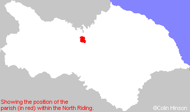
- For a detailed map of this parish see this parish boundaries map.
- For a more detailed map of the parishes in the riding please see the Yorkshire parish maps page.
- For a more detailed map of the county please see the Yorkshire map page.
- Here is a map showing the wapentakes for the county.
You can see maps centred on OS grid reference NZ332034 (Lat/Lon: 54.424955, -1.489808), Birkby which are provided by:
- OpenStreetMap
- Google Maps
- StreetMap (Current Ordnance Survey maps)
- Bing (was Multimap)
- Old Maps Online
- National Library of Scotland (Old Ordnance Survey maps)
- Vision of Britain (Click "Historical units & statistics" for administrative areas.)
- English Jurisdictions in 1851 (Unfortunately the LDS have removed the facility to enable us to specify a starting location, you will need to search yourself on their map.)
- Magic (Geographic information) (Click + on map if it doesn't show)
- GeoHack (Links to on-line maps and location specific services.)
- All places within the same township/parish shown on an Openstreetmap map.
- Nearby townships/parishes shown on an Openstreetmap map.
- Nearby places shown on an Openstreetmap map.
- This parish is covered by the following Society: