
Hide
Bossall
hide
Hide
hide
Hide
Hide
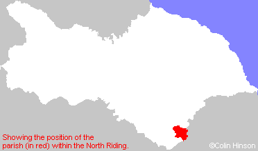
The Ancient Parish of BOSSALL
[Transcribed information mainly from the early 1820s]
"BOSSALL, a parish in the wapentake of Bulmer; 9 miles NE. of York. Here is a very handsome church dedicated to St. Botolph, and built in the form of a cross (see Churches for photograph), the living is a vicarage, in the patronage of the Dean and Chapter of Durham, of which the Rev. James Britton, D. D. is the incumbent. This place, which now consists of three houses, was once a considerable village. Foundations of many houses have from time to time been discovered in an adjoining field, which on that account is called " Old Bossall" Robert Belt, Esq. resides at Bossall. Population, 31."Information on the following places in this Parish is contained on a supplementary page.
|
|
[Description(s) edited mainly from various 19th century sources by Colin Hinson. ©2010]
Hide
- The list of Benefactions in St. Mary's Church, Sand Hutton.
- Here are photographs of Churches in the parish:
- St Botolph's Church, Bossall (view 1).
- Internal view looking down the aisle
- The font
- St Botolph's Church, Bossall (view 2).
- St John the Evangelist's Church, Buttercrambe.
- Internal view looking down the aisle
- The East Window
- The font
- St John the Evangelist's Church, Buttercrambe.
- St Mary's Church, Sand Hutton.
- Internal view looking down the nave
- The East Window
- The font
- St. Lawrence's Church, Flaxton.
- The Methodist Church, Claxton. Originally Primitive Methodist, founded in 1850.
- St Botolph's Church, Bossall (view 1).
- Transcript of the entry for Bossall in the "Collections relative to Churches and Chapels".
- Transcript of the entry for Buttercrambe in the "Collections relative to Churches and Chapels".
- Transcript of the entry for Flaxton in the "Collections relative to Churches and Chapels".
- Transcript of the entry for Sand Hutton Bossall in the "Collections relative to Churches and Chapels".
- The whereabouts and dates of the Registers etc. for the Parish of Bossall.
- The whereabouts and dates of the Registers etc. for the Chapelry of Buttercrambe.
- The whereabouts and dates of the Registers etc. for the Chapelry of Sand Hutton.
- The War Memorial on the outskirts of Sand Hutton.
- The List of Incumbents in St. Botolph's Church, Bossall.
- Andy Kerridge has written an article on Buttercrambe village giving a recent history and several photographs. There is also a copy of a map of Buttercrambe and Aldby made in 1633.
- Transcript of the entry of "professions and trades" in the Baines's Directory of 1823, of the North Riding.
- Transcript of the entry of "professions and trades" in the White's Directory of 1840, Yorkshire section.
- Transcript of the entry of "professions and trades" in the Bulmers Directory of 1890. of the North Riding.
- There is further information about this parish from the National Gazetteer 1868, Yorkshire extracts.
- There is further information about this parish from the Lewis's Topographical Dictionary of England 1835, Yorkshire extracts.
- There is further information about this parish from the Bulmer's 1890 History and Directory of the North Riding.
- Ask for a calculation of the distance from Bossall to another place.
- Here is an article on the Darleys of Wistow and Buttercrambe complete with a partial pedigree.
- In 1861 the township of Flaxton (a part in this parish and a part in the parish of Foston) by an Order in Council, was constituted a separate and independent parish. See Flaxton Parish.
- In 1861, Sand Hutton and Claxton (townships in this parish) were constituted a separate parish. See Sand Hutton with Claxton Parish.
- Andy Kerridge has transcribed the following articles:
- A description of the parish of Bossall with Buttercrambe by the Rev. NY. Hooper from the Sand Hutton and Claxton Chronicle (circa 1920).
- A description and history of Sandburn Cross.
- A Foundation stone laying at Sand Hutton.
- The Sand Hutton Fire Brigade.
- A description and history of Sand Hutton Hall from the Hull Mail, 1928.
- A description and history of Aldby Park from Country Life Magazine, 1935, written by Charles Hussey.
- An article on by Peter Darley on Buttercrambe's association with the history of British Thoroughbred racehorses.
- For a detailed map of this parish see this parish boundaries map.
- For a more detailed map of the parishes in the riding please see the Yorkshire parish maps page.
- For a more detailed map of the county please see the Yorkshire map page.
- Here is a map showing the wapentakes for the county.
You can see maps centred on OS grid reference SE719608 (Lat/Lon: 54.038177, -0.903618), Bossall which are provided by:
- OpenStreetMap
- Google Maps
- StreetMap (Current Ordnance Survey maps)
- Bing (was Multimap)
- Old Maps Online
- National Library of Scotland (Old Ordnance Survey maps)
- Vision of Britain (Click "Historical units & statistics" for administrative areas.)
- English Jurisdictions in 1851 (Unfortunately the LDS have removed the facility to enable us to specify a starting location, you will need to search yourself on their map.)
- Magic (Geographic information) (Click + on map if it doesn't show)
- GeoHack (Links to on-line maps and location specific services.)
- All places within the same township/parish shown on an Openstreetmap map.
- Nearby townships/parishes shown on an Openstreetmap map.
- Nearby places shown on an Openstreetmap map.
- The War Memorial Plaque in St. John's Church, Buttercrambe.
- The 1914-1918 and 1939-45 Memorial Plaques in Bossall Church.
- The War Memorial on the outskirts of Sand Hutton.
- This parish is covered (or partly covered) by the following Societies: