
Hide
Brignall
hide
Hide
hide
Hide
Hide
The Ancient Parish of BRIGNALL
[Transcribed information mainly from the early 1820s]
"BRIGNALL, a parish in the wapentake of Gilling West, and liberty of Richmondshire; 4 miles SE. of Barnard Castle. The church, which is an ancient structure, is dedicated to St. Mary (see Churches for photograph); the living is a vicarage, in the patronage of the King, incumbent the Rev. O. W. Kilvington, Here is a school erected in 1817, and allowed £15. per annum, by J. B. S. Morritt, Esq. Pop. 216.""GRETA BRIDGE, in the townships and parishes of Brignall and Rokeby, wapentake of Gilling West, and liberty of Richmondshire; 1 mile ESE. of Rokeby, 4 miles SE. of Barnard Castle, is a small village, taking its name from a bridge of one arch, over the river Greta, which river soon after runs into the Tees. The place is of modern erection, consisting of two handsome inns, one on each side of the bridge. Here are the remains of a Roman camp, where a number of coins and an altar were dug up some years ago.
Here are two Inns, the George Inn, (Post-Office) on the north side of the river; and the Moritt's Arms on the south, both Posting-houses."
"MOOR HOUSE, a farm house in the township and parish of Brignall; 1½ miles WSW. of Brignall, 2 miles from Gretabridge."
[Description(s) edited mainly from various 19th century sources by Colin Hinson. ©2010]
Hide
- Here are photographs of Churches etc. in the parish:
- St Mary's Church, Brignall view 1.
- St Mary's Church, Brignall view 2.
- The ruined St. Mary's Church, Brignall view 1.
- The ruined St. Mary's Church, Brignall view 2.
- Transcript of the entry for Brignall in the "Collections relative to Churches and Chapels".
- The whereabouts and dates of the Registers etc. for the Parish of Brignall.
- Transcript of the entry of "professions and trades" in the Baines's Directory of 1823, of the North Riding.
- Transcript of the entry of "professions and trades" in the Bulmers Directory of 1890. of the North Riding.
- There is further information about this parish from the National Gazetteer 1868, Yorkshire extracts.
- There is further information about this parish from the Lewis's Topographical Dictionary of England 1835, Yorkshire extracts.
- There is further information about this parish from the Bulmer's 1890 History and Directory of the North Riding.
- Ask for a calculation of the distance from Brignall to another place.
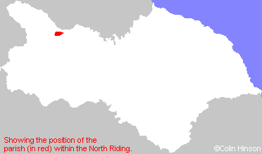
- For a detailed map of this parish see this parish boundaries map.
- For a more detailed map of the parishes in the riding please see the Yorkshire parish maps page.
- For a more detailed map of the county please see the Yorkshire map page.
- Here is a map showing the wapentakes for the county.
You can see maps centred on OS grid reference NZ072123 (Lat/Lon: 54.505965, -1.890321), Brignall which are provided by:
- OpenStreetMap
- Google Maps
- StreetMap (Current Ordnance Survey maps)
- Bing (was Multimap)
- Old Maps Online
- National Library of Scotland (Old Ordnance Survey maps)
- Vision of Britain (Click "Historical units & statistics" for administrative areas.)
- English Jurisdictions in 1851 (Unfortunately the LDS have removed the facility to enable us to specify a starting location, you will need to search yourself on their map.)
- Magic (Geographic information) (Click + on map if it doesn't show)
- GeoHack (Links to on-line maps and location specific services.)
- All places within the same township/parish shown on an Openstreetmap map.
- Nearby townships/parishes shown on an Openstreetmap map.
- Nearby places shown on an Openstreetmap map.
- The following places are within the boundaries of this (ancient) parish, but I have no further information on them other than the Ordnance Survey Landranger Grid reference shown:
- (NZ050114) Moor House (Farm)
- This parish is covered by the following Society: