
Hide
Bulmer
hide
Hide
hide
Hide
Hide
The Ancient Parish of BULMER
[Transcribed information mainly from the early 1820s]
"BULMER, a parish in the wapentake of Bulmer. (This place gives its name to the wapentake) 7 miles SW. of Malton. Here is a church, dedicated to St. Martin (see Churches for photograph). The living is a rectory, in the patronage of Earl Fitzwilliam, incumbent the Rev. William Preston. Population, 339.Bulmer was formerly the seat of the ancient family of the Idels."
"HENDERSKELFE, in the wapentake and parish of Bulmer; 1¾ miles NE. of Bulmer, 7 miles WSW. of Malton, containing a population of 159 souls." (There is further information for Henderskelfe).
"WELBURN, in the parish of Bulmer, and wapentake of Bulmer; 1¼ miles ENE. of Bulmer, 5½ miles SW. of Malton. Population, 352."
[Description(s) edited mainly from various 19th century sources by Colin Hinson. ©2010]
Hide
- Here are photographs of Churches in the parish:
- St Martin's Church, Bulmer.
- Internal view looking down the nave
- St. John the Evangelist's Church, Welburn.
- Internal view looking East down the nave
- Internal view looking West down the nave
- The East Window
- The font
- The former Methodist Chapel, Welburn.
- St Martin's Church, Bulmer.
- Transcript of the entry for Bulmer in the "Collections relative to Churches and Chapels".
- The brief History of St. John's Church, Welburn.
- The whereabouts and dates of the Registers etc. for the Parish of Bulmer.
- The List of Rectors of St. Martin's Church, Bulmer.
- The list of Priests of the Parish in St. John's Church, Welburn.
- Transcript of the entry of "professions and trades" in the Baines's Directory of 1823, of the North Riding.
- Transcript of the entry of "professions and trades" in the White's Directory of 1840, Yorkshire section.
- Transcript of the entry of "professions and trades" in the Bulmers Directory of 1890. of the North Riding.
- Here are two photographs of "Scatter Penny" in Bulmer village from Josephine Laxton:
- Scatter Penny circa 1910. The woman in the doorway is Josephine's Grandmother.
- The modern Scatter Penny. The house was in use by a family of Elliotts for a period of at least 50 years. from the early 1900's on. The Elliott Clan was associated with Castle Howard from the early 1800's. One Isaac Elliot from the extended Elliot(t) clan, as well as his sons Robert and Isaac, were Gamekeepers/Gillies at Castle Howard. Isaac Elliot Sr. being listed as Head Gamekeeper. This is noted in cenuses and the Will of Isaac Elliot(t). The Elliotts and extended families, have been associated with the castle until the present, not always carrying the Elliott name...Isaac and his wife are buried in Bulmer Village Churchyard, as well as the line of Elliotts associated with Bulmer village. These Elliotts, enmasse, originated in Scotland proper, were brought down to the borders of Scotland, as a noted fighting clan, to protect the border and were dispersed during the clearances. They then settled in Cumbria, and came down to Yorkshire in the late 1700's or early 1800's. [Josephine Laxton 2011]
- There is further information about this parish from the National Gazetteer 1868, Yorkshire extracts.
- There is further information about this parish from the Lewis's Topographical Dictionary of England 1835, Yorkshire extracts.
- There is further information about this parish from the Stephen Whatley's Gazetteer 1750, Yorkshire extracts.
- There is further information about this parish from the Bulmer's 1890 History and Directory of the North Riding.
- Ask for a calculation of the distance from Bulmer to another place.
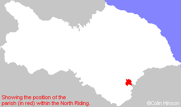
- For a detailed map of this parish see this parish boundaries map.
- For a more detailed map of the parishes in the riding please see the Yorkshire parish maps page.
- For a more detailed map of the county please see the Yorkshire map page.
- Here is a map showing the wapentakes for the county.
You can see maps centred on OS grid reference SE699677 (Lat/Lon: 54.100454, -0.932562), Bulmer which are provided by:
- OpenStreetMap
- Google Maps
- StreetMap (Current Ordnance Survey maps)
- Bing (was Multimap)
- Old Maps Online
- National Library of Scotland (Old Ordnance Survey maps)
- Vision of Britain (Click "Historical units & statistics" for administrative areas.)
- English Jurisdictions in 1851 (Unfortunately the LDS have removed the facility to enable us to specify a starting location, you will need to search yourself on their map.)
- Magic (Geographic information) (Click + on map if it doesn't show)
- GeoHack (Links to on-line maps and location specific services.)
- All places within the same township/parish shown on an Openstreetmap map.
- Nearby townships/parishes shown on an Openstreetmap map.
- Nearby places shown on an Openstreetmap map.
- The 1914-1918 War Memorial in Bulmer Village.
- The War Memorial Plaque in St. John's Church, Welburn.
- This parish is covered (or partly covered) by the following Societies: