
Hide
Gilling West
hide
Hide
hide
Hide
Hide
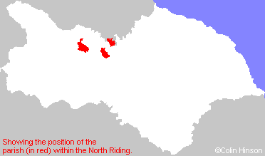
The Ancient Parish of GILLING WEST
[Transcribed information mainly from the early 1820s]
"GILLING WEST, a parish in the wapentake of Gilling West, and liberty of Richmondshire; 3 miles N. of Richmond; is a place of great antiquity, and once of sufficient consequence to give name to two wapentakes, Gilling East and Gilling West. The present vicar, his brother, has lately erected a noble vicarage, and improved the village very considerably. In addition to the parish church, which is dedicated to St. Agatha (see Churches for photograph), there are here a Methodist chapel and a National school, the latter of which affords instruction to 75 poor children. Population, including Hartforth and Stedbury, 921.About half a mile from Gilling is Gilling Wood hall, now a farm-house, but formerly the residence of a branch of the Duke of Wharton's family, it was burnt down about eighty years ago, and is now the property of John Wharton, Esq. of Skelton Castle, in Cleveland, M.P. for Beverley, who is Lord of the manor, and has a large estate here, with the patronage of the living. The free stone quarry of this place is of the finest quality, said to be one of the best in Yorkshire, and of which nearly all the bridges in the North Riding are built.
It was here that Oswyn, King of Deira, was murdered by Oswin of Bernicia, A.D. 651. To atone for this foul murder, Eanfleda, wife of Oswin, who was also related to Oswyn; founded the monastery of Ingethlingum, so called by Bede, not a Vestige of which is now to be seen. Gilling is remarkable also as having been the residence of the Saxon Edwin and his progenitors. The Castle, the seat of the Saxon Earls was situated upon a hill, nearly a mile to the south of the village, the vestiges of which were removed some time since."
Information on the following places in this Parish is contained on a supplementary page.
|
|
[Description(s) edited mainly from various 19th century sources by Colin Hinson. ©2010]
Hide
- Here are photographs of Churches in the parish:
- St. Agatha's Church, Gilling West view 1.
- Internal view looking across the nave
- St. Agatha's Church, Gilling West view 2.
- St. Mary's Church, Eryholme.
- St. Mary's Church, South Cowton, now disused, but still consecrated. (With short history).
- St. Luke's Church, North Cowton.
- Internal view looking down the nave
- The Methodist Church, North Cowton.
- The Old St. Luke's Church, North Cowton (a photograph of a painting in the new church).
- St. Agatha's Church, Gilling West view 1.
- Transcript of the entry for Gilling West in the "Collections relative to Churches and Chapels".
- Transcript of the entry for South Cowton in the "Collections relative to Churches and Chapels".
- Transcript of the entry for Eryholme in the "Collections relative to Churches and Chapels".
- Transcript of the entry for Forcett in the "Collections relative to Churches and Chapels".
- The whereabouts and dates of the Registers etc. for the Chapelry of Eryholme.
- The whereabouts and dates of the Registers etc. for the Parish of Gilling West.
- The whereabouts and dates of the Registers etc. for the Chapelry of South Cowton.
- Transcript of the entry of "professions and trades" in the Baines's Directory of 1823, of the North Riding.
- Transcript of the entry of "professions and trades" in the Bulmers Directory of 1890. of the North Riding.
- There is further information about this parish from the National Gazetteer 1868, Yorkshire extracts.
- There is further information about this parish from the Lewis's Topographical Dictionary of England 1835, Yorkshire extracts.
- There is further information about this parish from the Stephen Whatley's Gazetteer 1750, Yorkshire extracts.
- There is further information about this parish from the Bulmer's 1890 History and Directory of the North Riding.
- Ask for a calculation of the distance from Gilling West to another place.
- Between 1823 and 1890, the chapelry of Eryholme (in this parish) became a parish in its own right. See Eryholme Parish.
- Between 1823 and 1890, the townships of North and South Cowton (in this parish) became a parish in their own right. See South Cowton Parish.
- For a detailed map of this parish see this parish boundaries map.
- For a more detailed map of the parishes in the riding please see the Yorkshire parish maps page.
- For a more detailed map of the county please see the Yorkshire map page.
- Here is a map showing the wapentakes for the county.
You can see maps centred on OS grid reference NZ181051 (Lat/Lon: 54.440991, -1.722431), Gilling West which are provided by:
- OpenStreetMap
- Google Maps
- StreetMap (Current Ordnance Survey maps)
- Bing (was Multimap)
- Old Maps Online
- National Library of Scotland (Old Ordnance Survey maps)
- Vision of Britain (Click "Historical units & statistics" for administrative areas.)
- English Jurisdictions in 1851 (Unfortunately the LDS have removed the facility to enable us to specify a starting location, you will need to search yourself on their map.)
- Magic (Geographic information) (Click + on map if it doesn't show)
- GeoHack (Links to on-line maps and location specific services.)
- All places within the same township/parish shown on an Openstreetmap map.
- Nearby townships/parishes shown on an Openstreetmap map.
- Nearby places shown on an Openstreetmap map.
- The War Memorial at South Cowton.
- The following places are within the boundaries of this (ancient) parish, but I have no further information on them other than the Ordnance Survey Landranger Grid reference shown:
- (NZ169106) Carkin Fields
- (NZ175094) Carkin Grange
- (NZ164083) Carkin Moor
- (NZ152156) Moor Row
- This parish is covered by the following Society: