
Hide
Grinton
hide
Hide
hide
Hide
hide
Hide
Hide
The Ancient Parish of GRINTON
[Transcribed information mainly from the early 1820s]
"GRINTON, a parish in the wapentake of Hang West, and liberty of Richmondshire: 1 mile SE. of Reeth. The church, dedicated to St. Andrew (see Churches for photograph), is a very ancient structure, and has lately undergone many repairs; the windows, which are much corroded by time, are beautifully ornamented with stained glass. The living is a vicarage, in the patronage of the King. There were fairs formerly held here, but owing to its decreasing population they were transferred to Reeth, a market town in this parish. This parish is divided into four townships, each of which maintains its own poor, namely, Grinton, S. of the Swale: Reeth, on the N.; Melbecks, W. of Reeth; and Muker, on both banks of the Swale, which extends to the Dalehead. Population, 689."Information on the following places in this Parish is contained on a supplementary page.
|
|
|
[Description(s) edited mainly from various 19th century sources by Colin Hinson. ©2010]
Hide
- Photographs of over 270 gravestones in Grinton Cemetery with linked surname index.
- Photographs and Monumental Inscriptions of over 220 gravestones in the Graveyard with linked surname index.
- See also Monumental Inscriptions below for some of the Plaques in the Church.
- The Gunnerside website has transcriptions of some of the Census data for the Gunnerside area.
- Please see Christine Amsden's Census pages for the following Census transcriptions:
- Blades: 1851, 1861, 1901
- Feetham: 1851,1871, 1901
- Fremington: 1841, 1851, 1861, 1871, 1881, 1891, 1901
- Grinton: Complete from 1841 to 1901
- Gunnerside: Complete from 1841 to 1901
- Healaugh: Complete from 1841 to 1901
- Melbecks: 1841, 1851, 1861, 1871, 1891, 1901
- Muker: Complete from 1841 to 1901
- Reeth: 1841, 1851, 1861, 1871, 1891, 1901
- Here are photographs of Churches within the parish of Grinton:
- St Andrew's Church, Grinton. The Cathedral of the Dales.
- Internal view looking down the aisle
- Internal view looking west
- The font and cover
- The font and large font cover
- A postcard of St Andrew's Church, Grinton, circa 1910 (from a similar position to the one above).
- another view of St. Andrew's Church, Grinton.
- The former Roman Catholic Chapel, Fremington, view 1.
- The former Roman Catholic Chapel, Fremington, view 2.
- The Wesleyan Chapel, Reeth. Originally Wesleyan, founded 1797 and has now closed, the last service was on the 28th August 2016.
- The Congregational Church, Reeth. (The Church's website is here.)
- The Wesleyan Chapel, Healaugh, opened in 1845.
- Holy Trinity Church, Melbecks.
- Internal view looking down the aisle
- another view of Holy Trinity Church, Melbecks.
- The Methodist Chapel, Low Row.
- The United Reformed Church, Low Row (the new Smarber Chapel).
- The site of the Old Chapel, Smarber.
- The Wesleyan Church, Gunnerside. (The Church's website is here.)
- St. Mary's Church, Muker.
- Internal view looking down the aisle
- The font and cover
- another view of St. Mary's Church, Muker.
- The Methodist Church, Muker.
- The Old Chapel, Thwaite.
- The United Reformed Church, Keld.
- The Methodist Chapel, Keld.
- St Andrew's Church, Grinton. The Cathedral of the Dales.
- A transcript of Keld Congregational Church History
- A transcript of Low-Row Congregational Church History
- A transcript of Reeth Congregational Church History
- Transcript of the entry for Grinton in the "Collections relative to Churches and Chapels".
- Transcript of the entry for Muker in the "Collections relative to Churches and Chapels".
- The whereabouts and dates of the Registers etc. for the Parish of Grinton.
- The whereabouts and dates of the Registers etc. for the Chapelry of Muker.
- The List of Vicars in St. Andrew's Church, Grinton.
- The list of Vicars in St. Mary's Church, Muker.
- The list of Vicars and Curates in St. Mary's Church, Muker.
- The 2 Dales website covers Arkengarthdale and Swaledale.
- Here are photographs of the Grinton and Swaledale area, arranged in a Web Album.
- There are photographs (Ancient and Modern) of the Swaledale and Arkengarthdale on the 2 Dales Website.
- The village of Gunnerside has its own website describing the Gunnerside area.
- A website about The bus up the Dale - Percival Bros. coaches, 1921-1971.
- Transcript of the entry of "professions and trades" in the Baines's Directory of 1823, of the North Riding.
- Transcript of the entry of "professions and trades" in the Bulmers Directory of 1890. of the North Riding.
- There is further information about this parish from the National Gazetteer 1868, Yorkshire extracts.
- There is further information about this parish from the Lewis's Topographical Dictionary of England 1835, Yorkshire extracts.
- There is further information about this parish from the Bulmer's 1890 History and Directory of the North Riding.
- Ask for a calculation of the distance from Grinton to another place.
- John Hearfield has written a series of essays based on the censuses, covering Birkdale to Marrick.
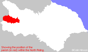
- For a detailed map of this parish see this parish boundaries map.
- For a more detailed map of the parishes in the riding please see the Yorkshire parish maps page.
- For a more detailed map of the county please see the Yorkshire map page.
- Here is a map showing the wapentakes for the county.
You can see maps centred on OS grid reference SE047984 (Lat/Lon: 54.381075, -1.929144), Grinton which are provided by:
- OpenStreetMap
- Google Maps
- StreetMap (Current Ordnance Survey maps)
- Bing (was Multimap)
- Old Maps Online
- National Library of Scotland (Old Ordnance Survey maps)
- Vision of Britain (Click "Historical units & statistics" for administrative areas.)
- English Jurisdictions in 1851 (Unfortunately the LDS have removed the facility to enable us to specify a starting location, you will need to search yourself on their map.)
- Magic (Geographic information) (Click + on map if it doesn't show)
- GeoHack (Links to on-line maps and location specific services.)
- All places within the same township/parish shown on an Openstreetmap map.
- Nearby townships/parishes shown on an Openstreetmap map.
- Nearby places shown on an Openstreetmap map.
- The World War I and II Memorial Plaques in St. Andrew's Church, Grinton.
- The World War I Memorial plaque in St. Mary's Church, Muker.
- The Indian Memorial plaque in St. Andrew's Church, Grinton.
- The World War I and II memorial in front of the Wesleyan Church, Gunnerside.
- The World Wars I and II memorial on the green at Reeth.
- See "Cemeteries" (above) for MIs for the Churchyard.
- The Monument to the wife of the Rev. Worthington in St. Andrew's Church, Grinton.
- The Monument to the Rev. Worthington in St. Andrew's Church, Grinton.
- The Monument to Edward Elliott in St. Andrew's Church, Grinton.
- The Monument to the Rev'd H.B. Worthington in St. Andrew's Church, Grinton.
- The Monument to Sir Francis Denys-Burton in St. Andrew's Church, Grinton.
- The Monument to Sir George William Denys and family in St. Andrew's Church, Grinton.
- The Monument to the Peacock family in St. Andrew's Church, Grinton.
- The Monument to the Swale family in St. Andrew's Church, Grinton.
- The Monument to Mary Scott in St. Andrew's Church, Grinton.
- The Monument to Rev'd. Thomas Edmondson in St. Andrew's Church, Grinton.
- The Monument to Rev'd. David Walker in St. Andrew's Church, Grinton.
- The Monument to Rev'd. Percy Smith and family in St. Andrew's Church, Grinton.
- The following places are within the boundaries of this (ancient) parish, but I have no further information on them other than the Ordnance Survey Landranger Grid reference shown:
- (NY906008) Crackpot Hall
- (NY896066) Tan Hill
- (SD973978) Smarber
- This parish is covered by the following Society: