
Hide
Hovingham
hide
Hide
hide
Hide
Hide
The Ancient Parish of HOVINGHAM
[Transcribed information mainly from the early 1820s]
"HOVINGHAM, a parish in the wapentake of Rydale; 7 miles S. of Kirkbymoorside. (the seat of Edward Worsley, Esq.) The church is dedicated to All Saints (see Churches for photograph); and the living is a perpetual curacy, of which the Earl of Carlisle, is the patron, and the Rev. Robert Freer, the incumbent; there is here also a Methodist chapel. Population, 649." (There is further information for Hovingham).Information on the following places in this Parish is contained on a supplementary page.
|
|
[Description(s) edited mainly from various 19th century sources by Colin Hinson. ©2010]
Hide
- The first list of legacies in All Saints Church, Hovingham.
- The second list of legacies in All Saints Church, Hovingham.
- Here are photographs of Churches etc. in the parish:
- All Saints' Church, Hovingham. (The Church's website is here.)
- Internal view looking down the nave
- The font
- All Saints' Church, Hovingham in springtime.
- The Church of St. George the Martyr, Scackleton. (The Church's website is here.)
- The ex-Methodist Chapel, Scackleton, now a private dwelling.
- All Saints' Church, Hovingham. (The Church's website is here.)
- Transcript of the entry for Hovingham in the "Collections relative to Churches and Chapels".
- Transcript of the entry for Fryton in the "Collections relative to Churches and Chapels".
- The whereabouts and dates of the Registers etc. for the Parish of Hovingham.
- Transcript of the entry of "professions and trades" in the Baines's Directory of 1823, of the North Riding.
- Transcript of the entry of "professions and trades" in the White's Directory of 1840, Yorkshire section.
- Transcript of the entry of "professions and trades" in the Bulmers Directory of 1890. of the North Riding.
- There is further information about this parish from the National Gazetteer 1868, Yorkshire extracts.
- There is further information about this parish from the Lewis's Topographical Dictionary of England 1835, Yorkshire extracts.
- There is further information about this parish from the Stephen Whatley's Gazetteer 1750, Yorkshire extracts.
- There is further information about this parish from the Bulmer's 1890 History and Directory of the North Riding.
- Ask for a calculation of the distance from Hovingham to another place.
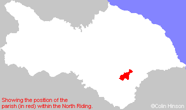
- For a detailed map of this parish see this parish boundaries map.
- For a more detailed map of the parishes in the riding please see the Yorkshire parish maps page.
- For a more detailed map of the county please see the Yorkshire map page.
- Here is a map showing the wapentakes for the county.
You can see maps centred on OS grid reference SE668756 (Lat/Lon: 54.171855, -0.978214), Hovingham which are provided by:
- OpenStreetMap
- Google Maps
- StreetMap (Current Ordnance Survey maps)
- Bing (was Multimap)
- Old Maps Online
- National Library of Scotland (Old Ordnance Survey maps)
- Vision of Britain (Click "Historical units & statistics" for administrative areas.)
- English Jurisdictions in 1851 (Unfortunately the LDS have removed the facility to enable us to specify a starting location, you will need to search yourself on their map.)
- Magic (Geographic information) (Click + on map if it doesn't show)
- GeoHack (Links to on-line maps and location specific services.)
- All places within the same township/parish shown on an Openstreetmap map.
- Nearby townships/parishes shown on an Openstreetmap map.
- Nearby places shown on an Openstreetmap map.
- The War Memorial Plaque in All Saints Church, Hovingham.
- The War Memorial in the Churchyard at Hovingham.
- This parish is covered (or partly covered) by the following Societies: