
Hide
Husthwaite
hide
Hide
hide
Hide
Hide
hide
Hide
The Ancient Parish of HUSTHWAITE
[Transcribed information mainly from the early 1820s]
"HUSTHWAITE, a parish in the wapentake of Birdforth, and liberty of St. Peter's; 4 miles N. of Easingwold. The living is a perpetual curacy, in the patronage of Joseph Reeve, Esq. incumbent this Rev. John Starkey. Pop. 324.""CARLTON HUSTHWAITE, in the parish of Husthwaite, wapentake of Birdforth, and liberty of St. Peter's; 1½ miles NW. of Husthwaite, 6 miles NW. of Easingwold. Here is a Chapel of Ease (see Churches for photograph), the Rev. J. Winter, curate. Pop. 169."
"HIGHTHORN, (the seat of William Hotham, Esq.) in the township and parish of Husthwaite; ½ mile SW. of Husthwaite, 4 miles from Easingwold."
"PEEP O'DAY, a farm house in the township and parish of Husthwaite; 2 miles SSE. of Husthwaite, 1½ mile from Easingwold."
[Description(s) edited mainly from various 19th century sources by Colin Hinson. ©2010]
Hide
- Here are photographs of Churches in the parish:
- St. Nicholas' Church, Husthwaite.
- St. Mary's Church, Carlton Husthwaite.
- Transcript of the entry for Husthwaite in the "Collections relative to Churches and Chapels".
- Transcript of the entry for Carlton Husthwaite in the "Collections relative to Churches and Chapels".
- The whereabouts and dates of the Registers etc. for the Parish of Husthwaite.
- Transcript of the entry of "professions and trades" in the Baines's Directory of 1823, of the North Riding.
- Transcript of the entry of "professions and trades" in the White's Directory of 1840, Yorkshire section.
- Transcript of the entry of "professions and trades" in the Bulmers Directory of 1890. of the North Riding.
- There is further information about this parish from the National Gazetteer 1868, Yorkshire extracts.
- There is further information about this parish from the Lewis's Topographical Dictionary of England 1835, Yorkshire extracts.
- There is further information about this parish from the Bulmer's 1890 History and Directory of the North Riding.
- Ask for a calculation of the distance from Husthwaite to another place.
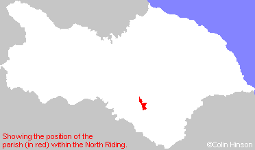
- For a detailed map of this parish see this parish boundaries map.
- For a more detailed map of the parishes in the riding please see the Yorkshire parish maps page.
- For a more detailed map of the county please see the Yorkshire map page.
- Here is a map showing the wapentakes for the county.
You can see maps centred on OS grid reference SE519751 (Lat/Lon: 54.169081, -1.20652), Husthwaite which are provided by:
- OpenStreetMap
- Google Maps
- StreetMap (Current Ordnance Survey maps)
- Bing (was Multimap)
- Old Maps Online
- National Library of Scotland (Old Ordnance Survey maps)
- Vision of Britain (Click "Historical units & statistics" for administrative areas.)
- English Jurisdictions in 1851 (Unfortunately the LDS have removed the facility to enable us to specify a starting location, you will need to search yourself on their map.)
- Magic (Geographic information) (Click + on map if it doesn't show)
- GeoHack (Links to on-line maps and location specific services.)
- All places within the same township/parish shown on an Openstreetmap map.
- Nearby townships/parishes shown on an Openstreetmap map.
- Nearby places shown on an Openstreetmap map.
- This parish is covered by the following Society: