
Hide
Marske By The Sea
hide
Hide
hide
Hide
Hide
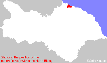
The Ancient Parish of MARSKE BY THE SEA
[Transcribed information mainly from the early 1820s]
"MARSKE BY THE SEA, a parish in the wapentake and liberty of Langbargh; 6 miles N. of Guisborough. Marske Hall, one of the seats of Lord Dundas, is an ancient and commodious mansion, built by Sir William Pennyman, Bart.; in the reign and according to the taste that prevailed about the time of Charles I. In the front of the building there are two shields cut in stone, bearing the arms of Pennyman and Atherton. The church, dedicated to St. Germain (see Churches for photograph), stands a little distant from the village towards the north-east, within a few yards from the sea cliff, the spire is a conspicuous sea-mark. The living is a vicarage, in the patronage of the Dundas family. Pop. 576.""REDCAR, in the parishes of Marske by the sea and Kirkleatham, wapentake and liberty of Langbargh; 2½ miles WNW. of Marske by the Sea, 7 miles N. of Guisborough. Formerly, this was only a small fishing village, composed principally of huts, but, latterly it has risen into considerable eminence as a sea-bathing place, and its fishing concerns have increased as the demand from the interior of the country has extended. There are here several good Inns, and a number of commodious lodging-houses, with machines and the other requisites for the accommodation of visitors; but in all parts of the year the town, near the beach, presents a somewhat dreary appearance, from the vast masses of sand which the winds of winter drift into the streets, and which are never wholly dissipated, The air of Redcar is, however, salubrious, and, the surrounding country, which presents the picturesque scenes of Marske, Guisborough, Skelton, Kirkleatham, is truly delightful. The population returns of this village present an extraordinary disparity, the females exceeding the males in the proportion of upwards of 3 to 2. The returns of 1821, stand thus: males 279, females 394, total 673. The difference accounted for by the men, who are chiefly in the sea-faring line, being obliged to emigrate, to find employment. It does not appear, however, that the progress of population stayed by the absence of so large a portion of the males, for, notwithstanding this circumstance, there has, during the last 10 years, been an actual increase of 5O Percent. The 10 years before it was retrograde, having diminished from 431, the amount in 1801, to 411, the number in 1811. The only place of worship in the town is a neat Methodist chapel but it has been determined to build a new church. The coast of Redcar is very rocky; and the navigation dangerous; but an excellent nautical chart, by Thompson, has lately been published, which has greatly diminished the number of shipwrecks, and the Life-boat, established here in 1802. which is very spacious and complete, renders these casualties less fatal when they do occur. It is stated on authority, that from 1800 to 1816, the number of vessels driven on shore, or lost off this coast, was, on an average, five annually, but that, from 1816 to 1821, the yearly average has been reduced to one and a half."
"SALTBURN BY THE SEA, in the parish of Marske by the sea. Saltburn by the sea did not exist in 1823, and does not appear on the maps of the 1860s. All that appears on the maps of that date is the railway station referred to in the Bulmer's 1890 Gazetteer (see under 'Gazetteers' below). The village of Saltburn was on the opposite side of Skelton Beck. Colin Hinson, 2005"
[Description(s) edited mainly from various 19th century sources by Colin Hinson. ©2010]
Hide
- Here are photographs of Churches in the parish (see also Kirleatham Parish for Redcar):
- St. Mark's Church, Marske by the Sea.
- Internal view looking down the nave
- The ruins of St. Germain's Church, Marske by the Sea.
- The Methodist Church, Marske by the Sea.
- St. Bede's Roman Catholic Church, Marske by the Sea.
- Emmanuel Church, Saltburn by the sea, view 1.
- Internal view looking down the nave
- The East Windows
- The font with its unusual cover
- Emmanuel Church, Saltburn by the sea, view 2.
- The Methodist Church, Saltburn by the sea, view 1.
- Internal view looking down the nave
- The Methodist Church, Saltburn by the sea, view 2.
- Our Lady of Lourdes Roman Catholic Church, Saltburn by the sea.
- The former Primitive Methodist Chapel, Saltburn by the sea, now a Community Theatre.
- St. Thomas's Church, New Marske.
- The Methodist Church, New Marske.
- St. Peter's Church, Redcar.
- Zetland Park Methodist Church, Redcar.
- St. Augustine's Roman Catholic Church, Redcar.
- East Cleveland Baptist Church, Redcar.
- St. Mark's Church, Marske by the Sea.
- A transcript of Redcar Congregational Church History
- Transcript of the entry for Marske by the Sea in the "Collections relative to Churches and Chapels".
- The whereabouts and dates of the Registers etc. for the Parish of Marske by the Sea.
- The whereabouts and dates of the Registers etc. for the Chapelry of Redcar.
- The List of Ministers in the Methodist Church, Saltburn by the Sea.
- The List of Vicars of Marske by the Sea.
- Transcript of the entry of "professions and trades" in the Baines's Directory of 1823, of the North Riding.
- Transcript of the entry of "professions and trades" in the White's Directory of 1840, Yorkshire section.
- Transcript of the entry of "professions and trades" in the Bulmers Directory of 1890. of the North Riding.
- There is further information about this parish from the National Gazetteer 1868, Yorkshire extracts.
- There is further information about this parish from the Lewis's Topographical Dictionary of England 1835, Yorkshire extracts.
- There is further information about this parish from the Bulmer's 1890 History and Directory of the North Riding.
- Ask for a calculation of the distance from Marske By The Sea to another place.
- In 1867, the new parish of Redcar was carved out of the parishes of Marske by the Sea and Upleatham. See Redcar Parish.
- For a detailed map of this parish see this parish boundaries map.
- For a more detailed map of the parishes in the riding please see the Yorkshire parish maps page.
- For a more detailed map of the county please see the Yorkshire map page.
- Here is a map showing the wapentakes for the county.
You can see maps centred on OS grid reference NZ640227 (Lat/Lon: 54.59544, -1.010978), Marske By The Sea which are provided by:
- OpenStreetMap
- Google Maps
- StreetMap (Current Ordnance Survey maps)
- Bing (was Multimap)
- Old Maps Online
- National Library of Scotland (Old Ordnance Survey maps)
- Vision of Britain (Click "Historical units & statistics" for administrative areas.)
- English Jurisdictions in 1851 (Unfortunately the LDS have removed the facility to enable us to specify a starting location, you will need to search yourself on their map.)
- Magic (Geographic information) (Click + on map if it doesn't show)
- GeoHack (Links to on-line maps and location specific services.)
- All places within the same township/parish shown on an Openstreetmap map.
- Nearby townships/parishes shown on an Openstreetmap map.
- Nearby places shown on an Openstreetmap map.
- The World War I Roll of Honour in Emanuel Church, Saltburn by the sea.
- The World War I Memorial Plaque in Emanuel Church, Saltburn by the Sea.
- The World Wars I and II War memorial at St. Marks church, Marske by the Sea.
- This parish is covered by the following Society: