
Hide
Sneaton
hide
Hide
hide
Hide
Hide
hide
Hide
The Ancient Parish of SNEATON
[Transcribed information mainly from the early 1820s]
"SNEATON, a parish in the wapentake & liberty of Whitby Strand; 3 miles SW. of Whitby. Here is an ancient church, dedicated to St. John (see Churches for photograph); the living is a rectory, of which the King is the patron, the Rev. John Hammond, the incumbent and the Rev. Timothy Cassley, the resident curate. Population, 251.""GALLOW GREEN, in the parish of Sneaton, wapentake and liberty of Whitby Strand; 2 miles SW. of Whitby."
"SNEATONTHORPE, in the parish of Sneaton, wapentake and liberty of Whitby Strand; 1¼ miles SE. of Sneaton, 4 miles S. of Whitby."
[Description(s) edited mainly from various 19th century sources by Colin Hinson. ©2010]
Hide
- Here are photographs of Churches etc. in the parish:
- St. Hilda's Church, Sneaton, rebuilt in 1823.
- Transcript of the entry for Sneaton in the "Collections relative to Churches and Chapels".
- The whereabouts and dates of the Registers etc. for the Parish of Sneaton.
- Transcript of the entry of "professions and trades" in the White's Directory of 1840, Yorkshire section.
- Transcript of the entry of "professions and trades" in the Bulmers Directory of 1890. of the North Riding.
- There is further information about this parish from the Pigot's 1829 Directory, Yorkshire section.
- There is further information about this parish from the Pigot's 1834 Directory, Yorkshire section.
- There is further information about this parish from the National Gazetteer 1868, Yorkshire extracts.
- There is further information about this parish from the Lewis's Topographical Dictionary of England 1835, Yorkshire extracts.
- There is further information about this parish from the Bulmer's 1890 History and Directory of the North Riding.
- Ask for a calculation of the distance from Sneaton to another place.
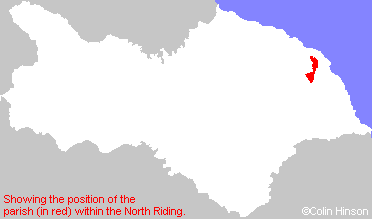
- For a detailed map of this parish see this parish boundaries map.
- For a more detailed map of the parishes in the riding please see the Yorkshire parish maps page.
- For a more detailed map of the county please see the Yorkshire map page.
- Here is a map showing the wapentakes for the county.
You can see maps centred on OS grid reference NZ894077 (Lat/Lon: 54.456827, -0.622511), Sneaton which are provided by:
- OpenStreetMap
- Google Maps
- StreetMap (Current Ordnance Survey maps)
- Bing (was Multimap)
- Old Maps Online
- National Library of Scotland (Old Ordnance Survey maps)
- Vision of Britain (Click "Historical units & statistics" for administrative areas.)
- English Jurisdictions in 1851 (Unfortunately the LDS have removed the facility to enable us to specify a starting location, you will need to search yourself on their map.)
- Magic (Geographic information) (Click + on map if it doesn't show)
- GeoHack (Links to on-line maps and location specific services.)
- All places within the same township/parish shown on an Openstreetmap map.
- Nearby townships/parishes shown on an Openstreetmap map.
- Nearby places shown on an Openstreetmap map.
- This parish is covered by the following Society: