
Hide
South Otterington
hide
Hide
hide
Hide
Hide
The Ancient Parish of SOUTH OTTERINGTON
[Transcribed information mainly from the early 1820s]
"SOUTH OTTERINGTON, a parish in the wapentake of Birdforth, liberties of Allertonshire and Ripon; 5 miles S. of Northallerton. There are two medieties in the Sectory of South Otterington, Gamwell House and Wetherill House. The church is dedicated to St. Andrew (see Churches for photograph); the living is a rectory, in the patronage of T. Bramby, gentleman, of which the Rev. Joshua Sampson, A. M. is the resident incumbent. Pop. 201." [Description(s) edited mainly from various 19th century sources by Colin Hinson. ©2010]
Hide
- Here are photographs of Churches etc. in the parish:
- St. Andrew's Church, South Otterington (view 1).
- St. Andrew's Church, South Otterington (view 2).
- Transcript of the entry for South Otterington in the "Collections relative to Churches and Chapels".
- The whereabouts and dates of the Registers etc. for the Parish of South Otterington.
- Transcript of the entry of "professions and trades" in the White's Directory of 1840, Yorkshire section.
- Transcript of the entry of "professions and trades" in the Bulmers Directory of 1890. of the North Riding.
- There is further information about this parish from the National Gazetteer 1868, Yorkshire extracts.
- There is further information about this parish from the Lewis's Topographical Dictionary of England 1835, Yorkshire extracts.
- There is further information about this parish from the Bulmer's 1890 History and Directory of the North Riding.
- Ask for a calculation of the distance from South Otterington to another place.
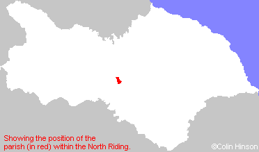
- For a detailed map of this parish see this parish boundaries map.
- For a more detailed map of the parishes in the riding please see the Yorkshire parish maps page.
- For a more detailed map of the county please see the Yorkshire map page.
- Here is a map showing the wapentakes for the county.
You can see maps centred on OS grid reference SE374876 (Lat/Lon: 54.282675, -1.427056), South Otterington which are provided by:
- OpenStreetMap
- Google Maps
- StreetMap (Current Ordnance Survey maps)
- Bing (was Multimap)
- Old Maps Online
- National Library of Scotland (Old Ordnance Survey maps)
- Vision of Britain (Click "Historical units & statistics" for administrative areas.)
- English Jurisdictions in 1851 (Unfortunately the LDS have removed the facility to enable us to specify a starting location, you will need to search yourself on their map.)
- Magic (Geographic information) (Click + on map if it doesn't show)
- GeoHack (Links to on-line maps and location specific services.)
- All places within the same township/parish shown on an Openstreetmap map.
- Nearby townships/parishes shown on an Openstreetmap map.
- Nearby places shown on an Openstreetmap map.
- The War Memorial in St. Andrew's churchyard, South Otterington.
- This parish is covered by the following Society: