
Hide
Burnsall
hide
Hide
hide
Hide
Hide
The Ancient Parish of BURNSALL
[Transcribed information mainly from the early 1820s]
"BURNSALL, a parish-town, in the east-division of Staincliffe, liberty of Clifford's-Fee; 9 miles from Pateley Bridge, 9½ miles N. of Skipton and 9 from Kettlewell, 43 from York. Pop. including Thorpe, 329. The Church is a rectory, dedicated to St. Wilfrid (see Churches for photograph), in the deanry of Craven, value in two medieties, £36. p.r. £63. Patrons, the Earl of Craven, and Robinson Chippendale, Esq. Two houses and a small parcel of land is in the parish of Linton.Here in 1612, Sir William Craven, Knight, Alderman of the city of London, and late Lord Mayor of the same, founded and endowed a Grammar School; and from an inscription over the door of the church, he appears to have repaired and beautified that handsome building. At the entrance of the choir of this church, each rector has his own stall and pulpit, and from which the service is alternately performed."
Information on the following places in this Parish is contained on a supplementary page.
|
|
|
[Description(s) edited from various 19th century sources by Colin Hinson © 2013]
Hide
- Bordley 1841 Census : Transcript of HO107/1315/15 fo.6-7
- Bordley 1851 Census : Transcript of HO107/2278 fo.60-61
- Bordley 1861 Census : Transcript of RG9/3183 fo.7
- Bordley 1871 Census : Transcript of RG10/4260 fo.7
- Bordley 1881 Census : Transcript of RG11/4303 fo.4
- Bordley 1891 Census : Transcript of RG12/3498 fo.4
- Bordley 1901 Census : Transcript of RG13/4026 fo.6b-7
- Bordley 1911 Census : Transcript of RG14/25745/47-57
- Here are photographs of Churches etc. in the parish:
- St. Wilfrid's Church, Burnsall (view 1).
- Internal view looking down the nave
- Internal view looking across the nave
- The 17th Century bier
- St. Wilfrid's Church, Burnsall (view 2).
- The Methodist Chapel, Burnsall (now dis-used).
- Centrally pivoted gate, St. Wilfrid's, Burnsall.
- St. Peter's Church, Rylstone.
- St. John the Baptist's Church, Appletreewick.
- Internal view looking down the nave
- St. Mary's Church, Conistone, view 1.
- Internal view looking down the nave
- St. Mary's Church, Conistone, view 2.
- Conistone Wesleyan Methodist Chapel, Conistone.
- Conistone Wesleyan Methodist Chapel, Conistone.
- The Methodist Church, Hetton. (The Church's website is here.)
- St. Wilfrid's Church, Burnsall (view 1).
- Transcript of the entry for Burnsall in the "Collections relative to Churches and Chapels".
- Transcript of the entry for Coniston in the "Collections relative to Churches and Chapels".
- Transcript of the entry for Rilston in the "Collections relative to Churches and Chapels".
- The whereabouts and dates of the Registers etc. for the Parish of Burnsall.
- The whereabouts and dates of the Registers etc. for the Chapelry of Conistone.
- The whereabouts and dates of the Registers etc. for the Chapelry of Rylstone.
- The list of Rectors in the Church, Burnsall.
- Transcript of the entry of "professions and trades" in the Baines's Directory and Gazetteer, Vol I, West Riding.
- Transcript of the entry of "professions and trades" in the Craven Household Almanack 1911, XXX
- There is further information about this parish from the National Gazetteer 1868, Yorkshire extracts.
- There is further information about this parish from the Lewis's Topographical Dictionary of England, Yorkshire extracts.
- There is further information about this parish from the Stephen Whatley's Gazetteer 1750, Yorkshire extracts.
- Ask for a calculation of the distance from Burnsall to another place.
- The Photograph of the Founder of St. John's Church, Appletreewick.
- Agreement for access from Bordley to Calton over Calton Moor 1640
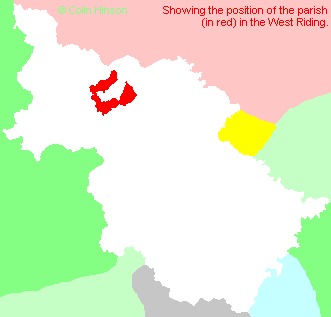
- For a detailed map of this parish see this parish boundaries map.
- For a more detailed map of the parishes in the riding please see the Yorkshire parish maps page.
- For a more detailed map of the county please see the Yorkshire map page.
- Here is a map showing the wapentakes for the county.
- Jeffreys' map : 1771
You can see maps centred on OS grid reference SE032614 (Lat/Lon: 54.048555, -1.952618), Burnsall which are provided by:
- OpenStreetMap
- Google Maps
- StreetMap (Current Ordnance Survey maps)
- Bing (was Multimap)
- Old Maps Online
- National Library of Scotland (Old Ordnance Survey maps)
- Vision of Britain (Click "Historical units & statistics" for administrative areas.)
- English Jurisdictions in 1851 (Unfortunately the LDS have removed the facility to enable us to specify a starting location, you will need to search yourself on their map.)
- Magic (Geographic information) (Click + on map if it doesn't show)
- GeoHack (Links to on-line maps and location specific services.)
- All places within the same township/parish shown on an Openstreetmap map.
- Nearby townships/parishes shown on an Openstreetmap map.
- Nearby places shown on an Openstreetmap map.
- The Tennant Family Memorial in the church at Conistone.
- The following places are within the boundaries of this (ancient) parish, but I have no further information on them other than the Ordnance Survey Landranger Grid reference shown:
- (SD965601) Fleets
- Bordley Wills and Probate : Procter family will transcripts.
- The will of Geoffrey Procter of Bordley 1524: Auditor to Henry, Earl of Northumberland
- This parish is covered by the following Society:
- A list of those paying the 1379 Subsidy Rolls (Poll Tax) for this parish.